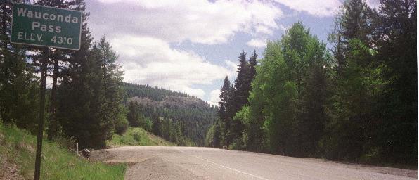
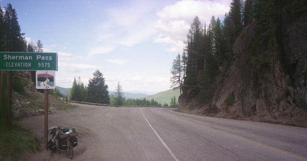
I rode two passes today but, unlike Rainy and Washington Passes, Wauconda and Sherman Passes are separated by a valley containing the town of Republic. All my riding today is on highway 20. Wauconda Pass is 25 miles from Tonasket with about 3000 feet of climbing on a mostly very pleasant road. I had a first breakfast before leaving Tonasket and a second, very good, breakfast at the store/gas station/cafe at Wauconda. Then I rode down into Republic (17 miles) and had desert and coffee at a bakery before tackling Sherman Pass. I enjoyed Wauconda pass, but the 17 miles to the top of Sherman pass seemed like they would never end. Part of the problem was that my computer was still out of wack from that gravel and I didn't realize it until I reached the top of the pass 10 miles (on my computer) before I expected to. Then I realized that it had only been registering part of the distance actually covered. It is so depressing to ride and ride and seem to only cover a hundredth of a mile!
There is another great downhill after Sherman Pass, about 4000 feet of vertical in the 30 miles to Franklin Roosevelt Lake. Kettle Falls is on the other side of the lake with a good climb on highway 20 (off the AC route) up to town. I stopped for the night at the Grand View RV Park and Motel (small room - I had to repack my bike so I could sleep in the bed - but pleasant) and the owner told me about a touring couple from Kenya who were headed east and had camped there the night before. 7430 feet of climbing and 85 miles.


