Day 21: Texline TX to Raton NM 95 miles with about 2500 feet of climbing
These 95 miles took me almost 8:45 as compared to 7:45 for 105 miles yesterday. The difference was the wind. Although the wind forecast was similar to the previous day (10 - 20 mph winds out of the south-southwest), the actual wind was out of the west - northwest for much of the day. I rode northwest for the first fifty miles and, as a result of the winds, I was only able to average about 10 mph. After about five hours of this the wind lightened and the strengthened out of the south west. Then I rode west into that wind. Finally, near the end of the day, I was riding northwest again with a south wind. Boy was I exhausted when I got to Raton.
New Mexico with Volcanic Cones

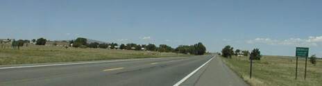
US 64 between Texline and Clayton
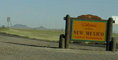
When I stopped for the night at Texline, I expected and easy ride into New Mexico and on to Clayton. I had an OK breakfast at the motel restaurant and was on the road by 8:15. Note that I crossed into the mountain time zone as I left town and entered New Mexico, so I really left at 7:15. It was nice to get into a new state and the shoulders were good and the scenery was good but the riding was very hard. I was able to maintain only 9.3 mph and had to work hard for over an hour to get to Clayton. In Clayton I stopped to refill my water bottles - the water in Texline was not good - and to pick up a bottle of gatorade as my fourth water bottle. It is 45 miles with no services between Clayton and Des Moines NM, and, with heat, low humidity, and a moderate headwind, I knew I would need a lot of water.
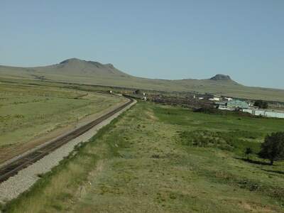
The cones from near Clayton
On my way out of Clayton, two guys in a van waved and beeped as they went by and then pulled off onto a side street and asked if I had time to visit. They were from Tulsa and one of them was going to ride to Des Moines that day after they had breakfast. I said I'd ride with him if he were going on to Raton (another 36 miles), but since he wasn't, I better head on down the road. Later, as I ground into that wind, I wished I had waited since the company would have been a good distraction!
Grenville - the only town between Clayton and Des Moines
After Clayton, which is a pretty little town, the grind resumed. I was questioning my sanity as well as the sanity of the other rider for even wanting to do this ride. It wasn't boring, the scenery was nice and getting nicer, but it was very hard work with little reward. There were a couple of reference points along the way, a dead town called Mt Dora and a live, but very small town called Grenville, as well as several intersections. The road kept climbing and the wind kept blowing and I, being very stubborn, kept pedalling.
I stopped several times to eat - I carried several cups of applesauce, several cups of pudding, some fig newtons, two candy bars, and three small tootsie rolls. I ate them all by my third stop. I stopped twice at the ends of passing lanes - they had marker posts that I could lean my bike against - and once at the only shade on the route, a single picnic table setup where the road (US 64 and US 87) crossed the Sante Fe Trail). This is very wide open country!
Finally, after four hours of grinding into the wind, the road turns northwest as it curves around the base of Sierra Grande a large volcanic cone heading around the base to Des Moines. Did I say this was pretty country? Sierra Grande is but the biggest of the extinct volcanos in this corner of New Mexico. Riding was much improved for the last ten miles or so into Des Moines.

Capulin Volcano note the symmetry and the road going to the top
I got to the restaurant in Des Moines, which was 56 miles from where I started, after over 5:30 of hard riding. I spent almost an hour at the restaurant, eating, resting, and recovering from that ride. Then I cranked on down the road, into the wind again and up hill again for the next ten miles. The scenery was even more spectacular here as the road runs around Capulin volcano, a beautifully symmetric cone. I stopped again in Capulin - about ten miles from Des Moines - for a coke and a candy bar at the combined store|restaurant. The man running the store told me that a group of bicyclists from South Africa had been there a few weeks ago. They were riding from Florida to the four corners area of Colorado.
Riding was better after Capulin becausgfe the road, although it was heading up hill, also was heading a bit north and the wind was a cross wind instead of a cross/head wind. After the crest of the hill at about 7000 feet, the road turned southward a bit for a few miles and I was actually going slower as I rode down hill! Fortunately it soon turned northward again and most of the remaining twenty miles to Raton was pretty easy (and very pretty) riding.
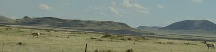
Antelope
In addition to the scenery, I enjoyed watching several antelope alongside the road. One actually paced me for about a mile. I also had a beautiful stallion that seemed to be challenging me. He came over snorting and prancing and then looked a bit confused <grin>.
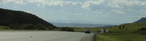
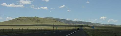
First view of the Rockies as seen from US 64 about twenty miles from Raton
When I go into Raton, I called my friend and former student who lives here and he brought his pickup out to give me a ride to his house. After I cleaned up and we had supper, I brought out my computer to show my days photos. The display wouldn't work and every thing I did to try to make it work, including trying to take it apart, failed. I had already decided to take a, badly needed, rest day, so I've been working on getting it fixed. No luck except that, after carrying it around town for an hour and a half, it started working again. I have little faith that it will continue to work and there is little or nothing I can do to repair it when it fails again, so these reports may stop at any time.
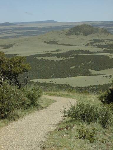
Looking Northwest from the top of Capulin
We also drove out to Capulin Volcano this morning, drove to the top (bicycles not allowed!!) and walked around the crater. The view is truly spectacular since the cone sticks up nearly 2000 feet above the plain and there are a lot of other volcanic cones nearby. You can really see Colorado - a couple of peaks - Texas near Texline - and Oklahoma - the highest hill in OK, as well as a huge amount of New Mexico east of the Continental Divide. It would be a nice bike ride up there, and an even nicer one back down - the road spirals around the mountain, if only it were allowed.
Tomorrow I head for Taos. It looks like I , briefly, have to ride on I-25, but then it is back to no services for a long way followed by Cimarron Canyon and some other really nice scenery before Taos. I hope the wind is my friend....


