Day 22: Raton to Taos NM: 95 miles with 3700 feet of climbing
What a (cultural) difference a day makes. I started out this morning in a working class town that feels like it is on the plains, although it is actually surrounded by mountains, and I end the day in the Laughing Horse Inn replete with incense, a room so small that my bed is above my head as write this and my bike and I barely fit, a dredlocked host and a shrine to Jerry Garcia. I like it! Most of Taos seems pretty phoney, but these folks seem to be genuine and have a sense of humor. Of course someone has just cranked up some obnoxious chanting, so there is a downside to the ambience of this place. Actually it is structured very much like a hostel and has the same kind of positives and negatives. It is several times as expensive as a hostel, but probably still one of the cheapest places to stay in Taos. I have my earplugs for sleeping. Riding today was mostly fun although hot and dry for the first half and cold and damp for the second half of the day. Even with the dripping skies and temperatures around 60 F, I rode an extra five miles or more just checking Taos - I've never seem so much fake adobe.. - out and I enjoyed the ride.
I started the morning with a great breakfast prepared by my friends and a somewhat sad leave taking. Then I rode south on the main drag of Raton till it becomes I-25, and then I rode past the 'no bicycles' signs (two of 'em) and onto I-25 south. Despite the no bicycle signs, I had to ride about four miles on I-25 in order to get to US-64 heading west. There are frontage roads and other roads in the same direction, but none of them reach US-64. I figured that, if I was stopped, I would just be nice and say 'Yes sir, I'll get off at the next exit! That exit was US-64.
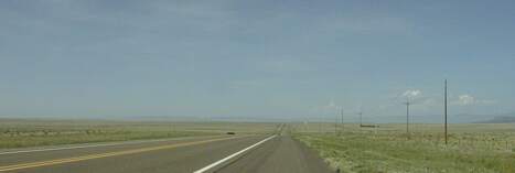
I didn't get stopped and riding was quite fast down I-25. I think I lost almost 400 feet of altitude in that four miles and averaged about 20 mph. Once on 64, I was able to crank along at about 15 mph over rolling hills with light winds. There was a good shoulder for the first eight miles, till NM 445 heads south, then no shoulder for about five miles. I stopped after riding 20 miles in about 1:15 at a culvert (culverts are the only place with privacy in these wide open spaces) where the shoulder resumed. Refreshed, I cranked on down the road, passing the only services between Raton and Cimarron, a tavern, about eight miles later.
I was having an excellent ride when a fellow in a pickup truck offered me a lift to Cimarron. I thanked him and declined, wishing that a similar offer had been made when I was cranking into the #$@$! Wind on my way to Des Moines. I would have accepted gladly! Of course, shortly after I declined the offer, the wind shifted and the road deteriorated.. I was only aking 12 mph and I was dealing with a lot of thumps to my bottom and to my computer (which thankfully survived) for the last ten miles to Cimarron. I reached Cimarron at noon, having ridden 40 miles in three hours.

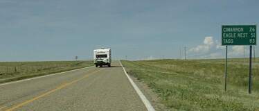
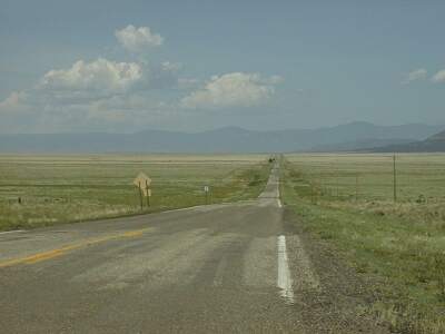
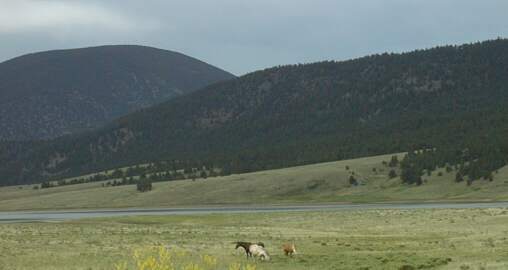
Leaving Cimarron, looking at storms over mountains
In Cimarron, which is the closest town to the large Philmont Boy Scout camp, I had very slow service for lunch, in part because of a group of scouts. On the other hand, Hecks, where I ate, was a friendly feeling place and the food was OK. After my 45 minute hamburger lunch, I rode on into Cimarron Canyon and Philmont property. Riding was very hot because I was doing a gentle climb with a moderate tail wind. Looking ahead I saw storm clouds gathering to the south. As I rode I heard thunder and saw lighting, but never directly in my path. It got cloudy and the wind changed to a head wind and then, a few miles before Ute Park, it began to rain lightly. I rode in intermittent light rain with temperatures in the low to mid 60s F for the rest of the day. It never got heavy enough for my rain gear, but it did get cold enough that I put on my wind jacket. It was hard to find the right clothing as temperature, rain, and slope varied.
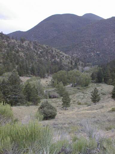
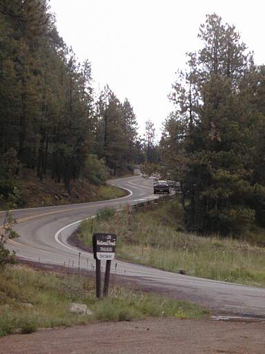
Cimarron Canyon climbs steadily from 6200 feet to about 7300 feet in a dozen miles or so and then 64 climbs much more steeply for two miles to reach 8300 feet. The photo above was taken looking back into the canyon from near the pass. There is no shoulder on any of this road, but traffic was pretty light and it wasn't a problem. My derailleur started acting up a bit - it will need a new cable soon - and I just used my 17 inch gear to crank up the steep part. I'd estimate it was a 6 to 7% grade. Not a bad climb, but the longest one on my route since I left North Carolina.
On the other side of that pass is Eagle Nest Lake and community. I stopped at a Subway(!) for a second lunch - which turned out to be an early supper as well - at about 4 PM , then I rode south toward Angel Fire and then west to Taos. The ride to Angel Fire was pretty easy; just riding in a high (8,000 feet) mountain valley, and a bit chilly. The ride from Angel Fire to Taos starts with a couple of miles of climbing. This was a harder climb than the one to Eagle Nest, but after this climb, the remaining 18 miles or so to Taos is almost all down hill!
Even in the light rain and 60 F temps that was one of the most fun downhill rides I've done. I noticed signs (two of 'em) at the top and a bit down the road telling bicyclists to stay right and ride single file. I bet they get a lot of 'bicyclists' who just ride down from the pass to Taos! It is a neat ride with only short stretches of uphill, mostly gentle, and long stretches of moderate (25 to 30 mph) downhill. Riding into, and thorugh Taos on US 64 was also fun. It is a mix of galleries, bed and breakfasts, motels, and auto repair shops with all but the last done up in adobe. Downtown is the same mix, minus the residences and auto repair, but with a lot of restaurants. It didn't appeal to me as I rode through it, but I'm sure it would be fun to walk around and shop. It is pretty and it is expensive...


