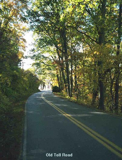
 Leaving my back yard, we ride briefly
through residential parts of Asheville before heading south up Old
Toll Rd. This road climbs part way up Beaucatcher Ridge ( Thomas Wolfe
made this ridge famous in ‘Look Homeward Angel’) and then
ends at Town Mountain road where our route turns north and finishes
the climb. It is a couple of miles from my house to this intersection
with 700 or 800 feet of climbing, mostly at 6% or so grade. There is
one, several block long, section with a 15% grade on Insbrook Road
just before Old Toll Rd.. Even with a 25" low gear on my road
bike I usually zig-zag up that hill.
Leaving my back yard, we ride briefly
through residential parts of Asheville before heading south up Old
Toll Rd. This road climbs part way up Beaucatcher Ridge ( Thomas Wolfe
made this ridge famous in ‘Look Homeward Angel’) and then
ends at Town Mountain road where our route turns north and finishes
the climb. It is a couple of miles from my house to this intersection
with 700 or 800 feet of climbing, mostly at 6% or so grade. There is
one, several block long, section with a 15% grade on Insbrook Road
just before Old Toll Rd.. Even with a 25" low gear on my road
bike I usually zig-zag up that hill.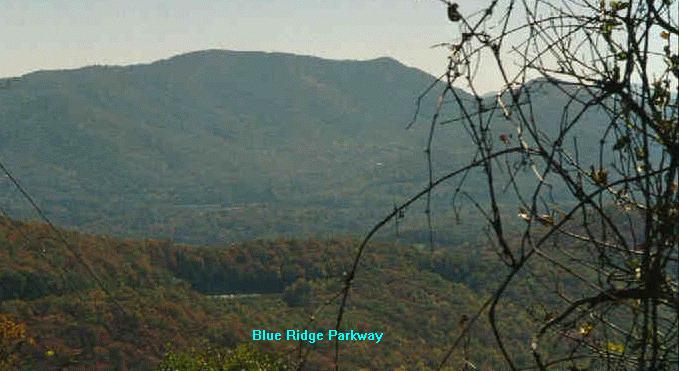
 The Blue Ridge Parkway is great
bicycling, although leaf season can bring too many cars and make
things unpleasant. This ride was on a weekday and traffic was
moderate. Here is a view looking up the Parkway shortly after Craven
Gap. This section is also pretty flat until Bull Gap where the Parkway
descends briefly and then starts a 10 mile long climb up to Craggy
Gardens. Just after the start of this climb you ride though a Tanbark
Ridge Tunnel. Here is a shot from just inside that tunnel looking back
down the road. There are two other short tunnels on this route, one on
either side of Craggy Gardens, but this is the only tunnel long enough
to require at least some sort of rear light. I don’t use a front
light going through it, but coming down I’ve come (too) close to
hitting the wall (at 30 mph...) because I couldn’t see where I
was going. The tunnel is almost straight and you can see through it,
but it long enough to get rather dark in the middle.
The Blue Ridge Parkway is great
bicycling, although leaf season can bring too many cars and make
things unpleasant. This ride was on a weekday and traffic was
moderate. Here is a view looking up the Parkway shortly after Craven
Gap. This section is also pretty flat until Bull Gap where the Parkway
descends briefly and then starts a 10 mile long climb up to Craggy
Gardens. Just after the start of this climb you ride though a Tanbark
Ridge Tunnel. Here is a shot from just inside that tunnel looking back
down the road. There are two other short tunnels on this route, one on
either side of Craggy Gardens, but this is the only tunnel long enough
to require at least some sort of rear light. I don’t use a front
light going through it, but coming down I’ve come (too) close to
hitting the wall (at 30 mph...) because I couldn’t see where I
was going. The tunnel is almost straight and you can see through it,
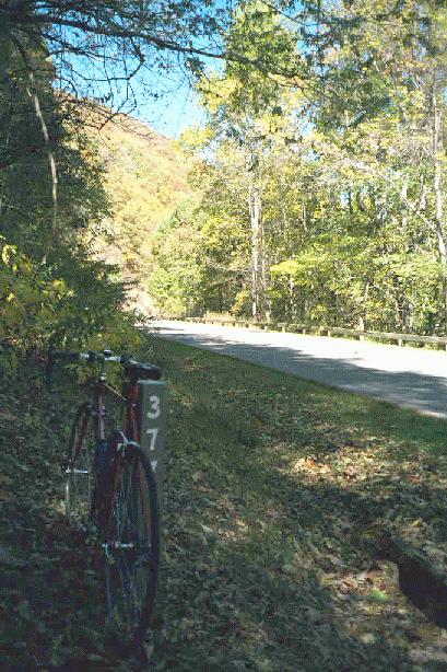
but it long enough to get rather dark in the middle.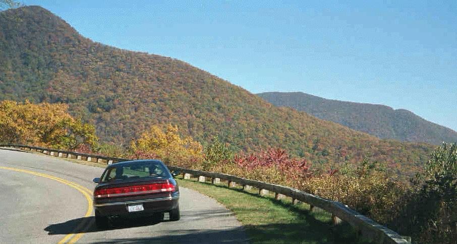 After the tunnel you are in for a pretty steady
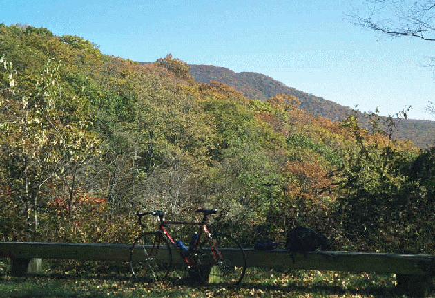
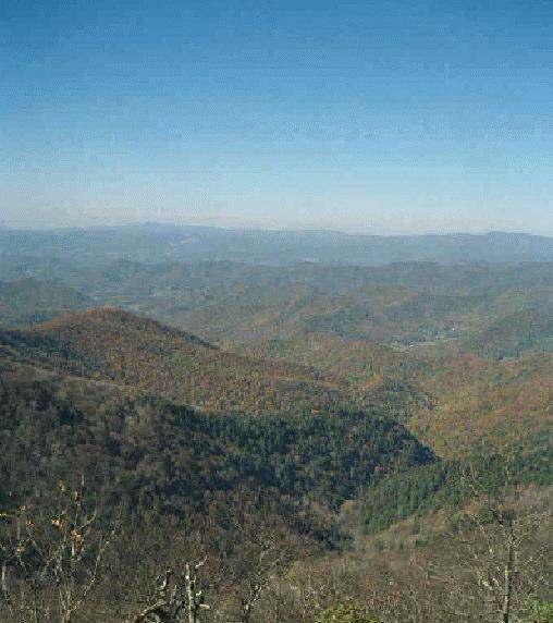
climb of about 2000 feet in the next 10 miles. Very pretty riding made
even more interesting because it goes through several climatic zones
with different vegetation. The views are nice too! Several places
along the way allow you to see the Parkway far ahead of you. Here is a
picture, taken a few miles beyond the tunnel, which shows the Parkway
as a small notch it the hill half a dozen miles away. The next picture
is of my bike with some pretty scenery in the background. I stop for a
rest/food break about 16 miles (and an hour and 40 minutes or so) into
this ride. My stopping place is a cut in the mountain which has
breathtakingly beautiful colors in the fall. They don’t come
across (actually none of these images do) in this medium nearly as
beautiful as they are. If you’ve been lucky enough to see some
good Elliot Porter prints of fall colors, then these should look like
those!
After the tunnel you are in for a pretty steady
climb of about 2000 feet in the next 10 miles. Very pretty riding made
even more interesting because it goes through several climatic zones
with different vegetation. The views are nice too! Several places
along the way allow you to see the Parkway far ahead of you. Here is a
picture, taken a few miles beyond the tunnel, which shows the Parkway
as a small notch it the hill half a dozen miles away. The next picture
is of my bike with some pretty scenery in the background. I stop for a
rest/food break about 16 miles (and an hour and 40 minutes or so) into
this ride. My stopping place is a cut in the mountain which has
breathtakingly beautiful colors in the fall. They don’t come
across (actually none of these images do) in this medium nearly as
beautiful as they are. If you’ve been lucky enough to see some
good Elliot Porter prints of fall colors, then these should look like
those!
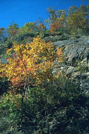
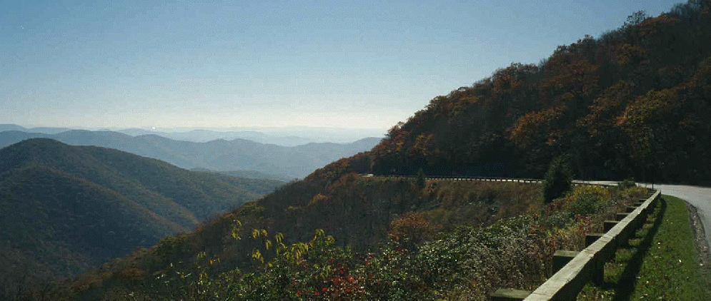
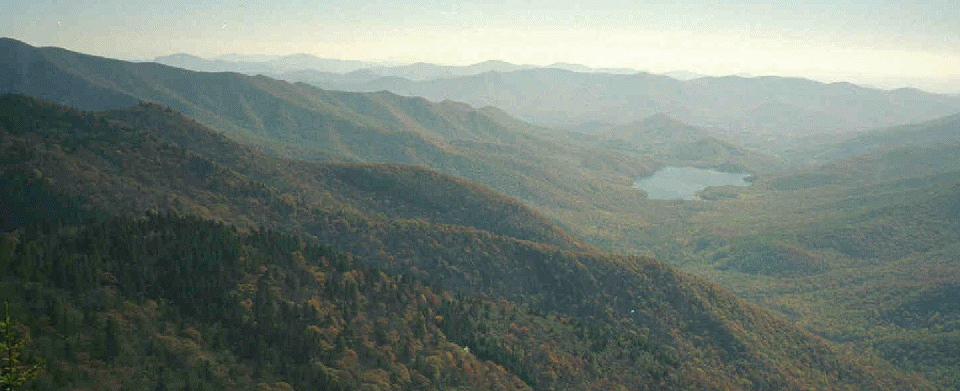
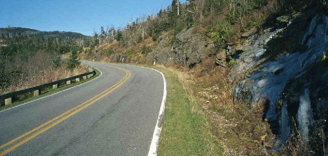
 As we continue to climb, we sweep around a valley and pass the
road to the Craggy Gardens picnic area. We are now at close to 5000
feet and, a mile or so past that road, we can look back on the way
we’ve come and, on this rare clear day,
see mountains 50 miles away. Looking the other way , we see the
Parkway climbing past a wall of glistening rock. That same rock is
covered by a foot or more of ice in the winter.
As we continue to climb, we sweep around a valley and pass the
road to the Craggy Gardens picnic area. We are now at close to 5000
feet and, a mile or so past that road, we can look back on the way
we’ve come and, on this rare clear day,
see mountains 50 miles away. Looking the other way , we see the
Parkway climbing past a wall of glistening rock. That same rock is
covered by a foot or more of ice in the winter.
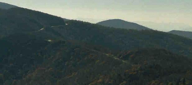
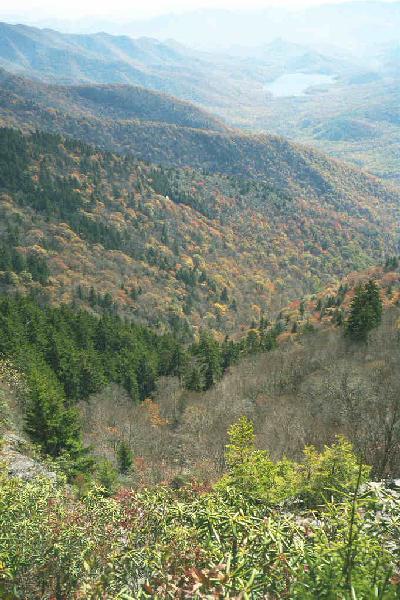
We are now approaching the notch we saw several valleys ago and the
Parkway has a very different look than it did near Asheville. After
going though that notch, we head up a long hill that hugs the
mountainside near the top of a ridge. You can clearly see this part of
the Parkway from I-40 near the town of Black Mountain. It is really
pretty awesome to look up there and realize that you have ridden
it. The first photograph was taken looking back towards the notch and
Asheville from near the Craggy Flats Tunnel. The second was taking
looking east form the same spot. After passing through that short
tunnel and climbing another few hundred feet, you pass the Craggy
Gardens Visitor Center. This is a pretty spectacular place since it is
right on top of a mile high ridge with dramatic views in both
directions. It is especially dramatic when the weather is quite
different on the two sides of the ridge.
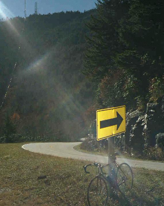
 When you finally turn away from that valley, it is
mostly downhill to Rt 128 which goes from the Parkway to the top
of Mt Mitchell. It is 30 miles with about 4500 feet of climbing to
Rt. 128 from my house. On Rt 128 you have less than 3
miles to go, with 1200 ft of climbing, almost all of which is in a single 2
mile long hill before you reach Mt Mitchell State Park. Then things
are much easier for the next two miles and then, if you go to the top,
the last half a mile is pretty steep. Here is a shot of the road near
the top. That is Mt Clingman
in the background with radio antennae on top. This stretch of 128
maintains a pretty steady 10 % grade. It isn’t fun for tired
legs, but it is doable and, for me, the thought of a good meal at the
restaurant on top is enough to keep me going for the half an hour
(I’ve done it in 20 minutes and I’m sure the best Assault
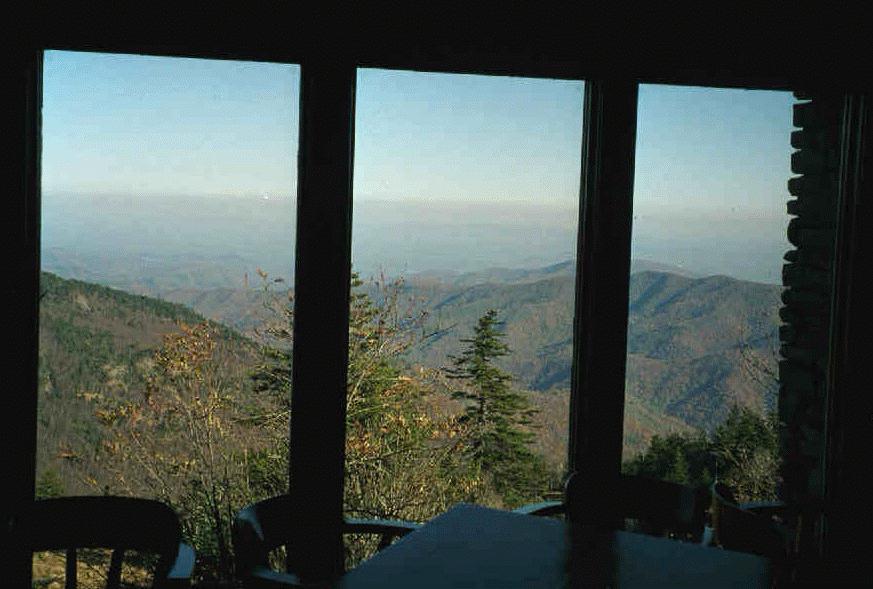
folks do it in less than 10...) it takes to cover that 3 miles. Here
is a shot taken from inside the restaurant. Nice view!
When you finally turn away from that valley, it is
mostly downhill to Rt 128 which goes from the Parkway to the top
of Mt Mitchell. It is 30 miles with about 4500 feet of climbing to
Rt. 128 from my house. On Rt 128 you have less than 3
miles to go, with 1200 ft of climbing, almost all of which is in a single 2
mile long hill before you reach Mt Mitchell State Park. Then things
are much easier for the next two miles and then, if you go to the top,
the last half a mile is pretty steep. Here is a shot of the road near
the top. That is Mt Clingman
in the background with radio antennae on top. This stretch of 128
maintains a pretty steady 10 % grade. It isn’t fun for tired
legs, but it is doable and, for me, the thought of a good meal at the
restaurant on top is enough to keep me going for the half an hour
(I’ve done it in 20 minutes and I’m sure the best Assault
folks do it in less than 10...) it takes to cover that 3 miles. Here
is a shot taken from inside the restaurant. Nice view!
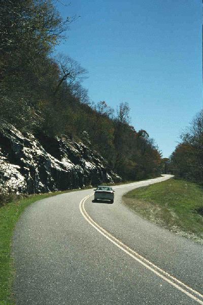
Coming back down Mt Mitchell is a
great experience if you like speed. The road that took half a hour
going up can be covered in a few minutes going down. It is twisty
enough to be challenging at 45 mph and steep enough to make it
possible for me to hit near 50 (typically 48) on the fast bits and
average about 40 mph from the gate of the state park to the
Parkway,

 Once on
the Parkway again, the reality of the ride home sets it. There is only
1500 feet of climbing on the way back and 1200 of that comes before
you reach Craggy. Those 10 miles usually take me about an hour. Then
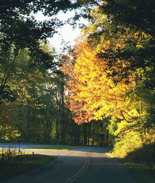
there is that great 10 mile downhill from Craggy back to near Bull Gap.
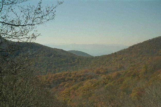
There is only one brief uphill section in the entire 10 miles. As I’m
getting near the end of that section, it is getting to be late in the
afternoon. Here is a shot taken a mile or so before I got to Tanbark
tunnel. Pretty fall colors in the late afternoon light.
Once on
the Parkway again, the reality of the ride home sets it. There is only
1500 feet of climbing on the way back and 1200 of that comes before
you reach Craggy. Those 10 miles usually take me about an hour. Then
there is that great 10 mile downhill from Craggy back to near Bull Gap.
There is only one brief uphill section in the entire 10 miles. As I’m
getting near the end of that section, it is getting to be late in the
afternoon. Here is a shot taken a mile or so before I got to Tanbark
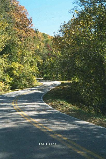
tunnel. Pretty fall colors in the late afternoon light.We have one more climb of a few hundred feet after we exit the Parkway at Craven Gap and head up and over the ridge. Then it is almost all downhill to Asheville. Both the esses and Old Toll road are great fun, even at the end of a long hard ride. We've come about 65 miles and climbed over 6500 feet. Time for a good supper and some ibuprophen!