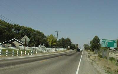
Day 36 Twin Falls to Glenn's Ferry ID: 70 miles with 1200 feet of climbing
I took an easy day today. My legs were tired from yesterdays ten hour ride and I got a late start because I wasn't able to finish that ride report until this morning. Anyway, it was a good, if hot, days riding mostly along US 30 which roughly follows the Snake River. The best riding of the day was actually in the Snake River Canyon and the worst was on I-84. Most of the day was spent riding through small towns and agricultural areas near the river. My overall impression of this area is that the sound of running water is everywhere. There is so much water being used for irrigation in a place that would otherwise be like a desert that I almost always could hear the water flowing as I rode.
I started riding today at 9:45 and stopped for a second breakfast before I left Twin Falls, so it was well after ten when I got out of town. US 30 was surprisingly urban - a busy four lane highway - till after ID 93 headed off south to Wells NV. Then it was a busy two lane with, at first, a good shoulder and, later, an inadequate one. This part of the ride wasn't much fun. I stopped in Buhl at a grocery store to stock up on snacks: bagels and cups of tapioca pudding. My second breakfast, potato pancakes that were a cross between latke and pancakes, was very filling so I really wasn't hungry yet, but I knew it was a long way to Hagerman and that I would need a snack.
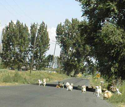
Looking back at the dogs - this is about half of the ones that chased me
After leaving Buhl, I was confused when the road seemed to turn east. I think there was some kind of magnetic anomaly that messed up my compass. Anyway, I immediately headed up the steepest hill around to explore. That worked, after a fashion, because I was able to see the Snake River Canyon and orient myself, but before I got oriented, I did some exploring. On one rural road I head a dog start barking at me. I said "Cool it, dog(s)." as a veritable flood of dogs came barking out into the road to chase me. The road was almost filled with dogs, none of whom seem particularly hostile, but some were in danger of getting in front of my bike. A little later I rode back past the same house and ran the gamut again. I guess not many folks ride that road!
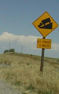
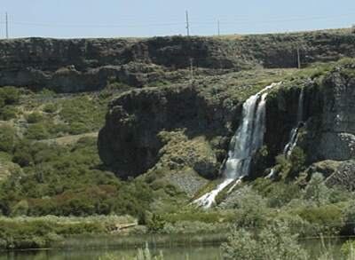
When 30 finally got to the Canyon, after quite a few direction changes, a sign said 6% grade, 3 miles. Wow, that is a deep Canyon! Let's see, 6% is 600 feet in 10000 feet so 6% for three miles would be about a 900-foot drop. Actually the drop is maybe 300 feet and the 6% grade is the maximum slope with an average
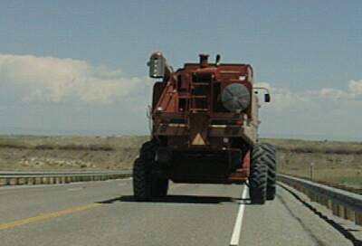
slope of about 2%! Going down was interesting since I was first overtaken by and then overtook a combine. He could only go 20 mph or so and I couldn't go that fast into the wind on the 2% part, but I caught and passed (legs spinning very fast) him on the 6% part. Most of the valley floor is farm land. More sounds of rushing water, but this time some of it is from waterfalls coming out of the north canyon wall. I stopped to enjoy the view and have a snack.
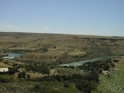
In a few miles, the road crosses the river and heads across the valley on the other side. It is a few miles of rolling hills to Hagerman, which is a small town with all services. Tourism is a major industry in Hagerman Valley, but there is also a big fish hatchery, at least one fish farm operation, and lots of farming. I stopped for lunch in Hagerman, then climbed out if town looking for the road up the north side of the canyon. The climb looks impressive, but it only climbs a few hundred feet with a gentle grade.
The best part of the climb is the views of the valley. There is a view spot near the top and, if you are on a bicycle, another good viewing place right before the top.
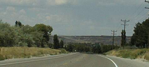
After climbing out of the canyon, riding is pretty boring. I stopped in Bliss for a milkshake and quick look at my mapping software and routing instructions on my computer. Then I decided to ride I-84, instead of back roads, to Glenn's Ferry. I was tired, it was very hot and dry - one of the strange things about this part of the world is you hear and see all that water, but you are riding through very arid country - and I needed to do some work on my bike, so I took the quicker route.
Five miles later,as I approached a rest stop, I had a flat tire ! I walked my bike into the rest stop and fixed the flat in the shade of a picnic shelter. This time it was a thorn, not a truck tire wire. When I got to Glenn's Ferry, the lady at the motel warned me not to take my bike off of the pavement. She said there was a very bad plant with thorns that would give me a flat tire. Of course my Top Touring tire with thorn proof tube wouldn't get flats . . .
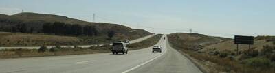
The ride on I-84 has some very nice views - the back roads route should be even better - and one major hill - the back roads route has more climbing. As I was coming down a hill toward the Snake River before that big climb, I passed a truck that had just pulled over onto the shoulder. His front, drivers side, tire had disintegrated, and I could see, in the midst of wire and rubber fragments, almost the entire shiny inside of the rim. Eighty percent or more of the tire was gone, left somewhere on the road for bicyclists to run over <grin>.


