Day 25: Dulce to Aztec NM. 80 miles with 3200 feet of climbing
I considered a lot of possible destinations for this day, but ended up in one I hadn't considered. This was a result of meeting a fellow tourist and a chance encounter with some local folk who fed me and gave my routing advice. As a result, I did a lot more climbing on a much more interesting route and I ended up in a more pleasant town. Tomorrow I'll be routing into Colorado to Cortez probably, instead of heading out into the Arizona desert as I had planned. I think I'll give Arizona and Nevada a pass on this trip - July just isn't the right time of year to visit those states!
I enjoyed my rest day in Dulce and I got a lot done. Bike repair and web page creation took most of the day. I stayed at the Best Western from 11:30 AM till 8:30 the next morning, going out only to get some paper towels that I needed for cleaning my chain. It was a pleasant and productive rest day. This morning, I woke up at 7, but didn't get on my way till after 8:30. Folks in Dulce take somewhat relaxed view of life which slowed my departure a bit.
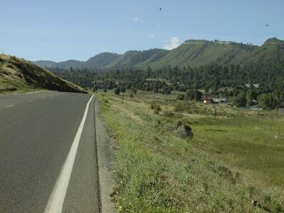
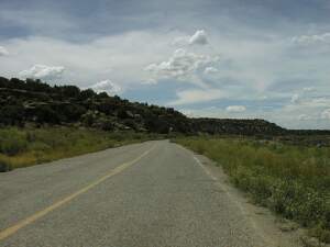
Heading west on 64 means heading south out of Dulce following Dulce creek. It is quite beautiful and very nice riding. A long gradual uphill ends, eleven miles later, with a fairly steep climb over the top of a ridge. There is about 800 feet of climbing in that 11 miles with about half of it in the last mile. My BB, which began creaking when I use my granny after riding in the rain near Elk City OK, now creaks even louder. I had hoped lubing the chain would help, but it didn't and neither did spraying WD-40 on the mounting for the granny ring which is really a freewheel cog. Oh well, I guess I'll just learn to ignore it since I can't do anything about it till I get home!
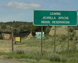
After the climb out of Dulce, there is a descent into much dryer and more open country. It was also much windier today. Then 64 heads southwest and the wind, which was variable in intensity, seemed to be pretty much from the southwest. Since the wind came and went and since the road was basically downhill, riding was still pretty good. At 20 miles, US 64 left the reservation and entered Carson National forest. After about 25 miles, I stopped at a culvert to rest and snack.
When I was getting ready to leave the culvert, I saw a wondrous sight: a loaded bicyclist was coming east on US 64! Bernard, who is Swiss, had ridden a rather rambling route down from Rapid City SD and is heading for Santa Fe. We visited about routes and he mentioned that he had spent the previous night in Aztec NM. He also asked if I was planning to see Navaho Dam. I said I wasn't. He bemoaned traffic in and around Farmington and said he had ridden from Cortez to Farmington. I told him about Dulce and Chamas. He was surprised when I said it was an easy ride between them. He pointed out that the continental divide was between them. Hmm, so it is, but it sure wasn't very noticeable or well marked!
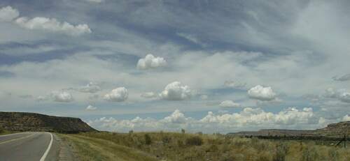
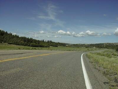
After Bernard left, I headed on down 64 enjoying the ride, if not the head wind. Since it continued to be mostly downhill, my average speed stayed around 12 mph and the wind kept me cool <grin>. The scenery wasn't very interesting for a while, but it did improve as the mesas became more prominent. At about forty miles I stopped for another break, and at fifty miles I spotted a sign for the first services since Dulce.
The sign offered cold drinks, sandwiches, and donuts at the next turn. That turn was at Navaho City and the road headed toward Navaho Dam. The only thing on the road was a house with a dirt parking area which didn't look too promising, but I rode down anyway. Two fellow were talking by several vehicles, so I parked my bike against the house and looked their way. One asked, in a friendly way, if there was anything I needed. I said no, but I had seen the sign and I hoped to get a snack. He explained that he had a mobile food setup, but that it was currently in Greeley. He then offered me a slice of watermelon and, a bit later a sandwich and a coke. He and his son were very friendly and we discussed towns and roads in the area. They didn't think much of most of the towns, but liked Aztec. I said I'd go there. 'Hmm, If you are going to Aztec, don't go on 64, go on up to the Navaho Dam and take the road along the river to Aztec.' What, says I, about eating along the way? 'No problem, there is a good restaurant at Navaho Dam city which is about midway from here to Aztec. 'What about hills? 'Oh, it is only a little hillier than going on 64.' Well, it looked a lot hillier on my map, but OK, I'm sold.
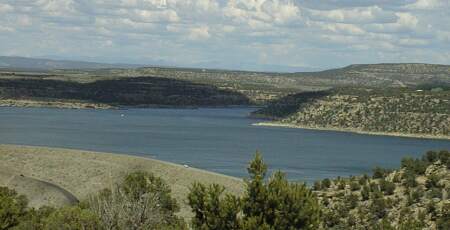
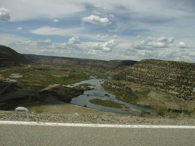
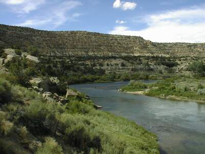
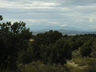
Well, I rode NM 539 to Navaho Dam - hilly but spectacular views as you ride across the dam, and then NM 511 to Navaho Dam community - nice, and a bit hilly, and then NM 173 to Aztec - wow is that a hilly road! There is a gospel song titled "One more valley, one more hill." That is the way I came to feel about 173. It is 17 miles from Navaho Dam community to Aztec. That 17 miles took me about two hours, much of it cranking (creaking) up 10% grades. Most of the hills were pretty short, but it seem like for every two hundred feet I climbed, I lost one hundred and fifty feet before having to climb another 200 feet. Two thousand feet of climbing in about 14 miles - then it goes downhill - is a lot, especially when the hills are steep. The view from the top is spectacular, but there are a lot of false summits to get through before you get that view!
The restaurant/bar was good. The views were great and the riding was good if a little tiring. This route is a lot more fun than staying on 64, but also a lot more work. Aztec is nice and the motel, The Step Back Inn, that the folks at Navaho City (their house is Navaho City...) recommended is very pleasant. Tomorrow, Colorado.


