My first Tour of 2000 - two passes between TN and NC
On Jan 1, 2000 I rode my, lightly loaded, touring bike to a friends house 36 miles from Asheville and only a few miles from where US 19E and US 19W split. On Jan 2, I rode 106 miles from there over to Erwin Tennessee via one pass (we call 'em gaps around here) and back into NC via another. I also did several other 'gaps' in NC on my way back to Asheville.
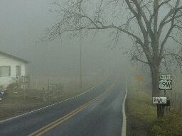 I left my friends house at about 8:45 AM, descending into fog at about 2600 feet. I rode the first 20 miles in fog with temps from 35 to 40 F. The road I used this morning, US 19 W follows the Cane River west, and therefore down river, for 18 miles. By the time 19 W actually left the Cane River and started climbing, instead of descending, the fog level had dropped from 2700' to about 2400'. I had started at 2800', but descended quickly to 2600' and then gradually to 2200'. Even with the fog, it was nice riding. Above the fog it was great riding.
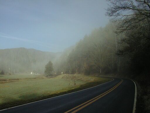
Leaving the Fog
After I got out of the fog, the road climbed steadily to Spivey Gap. The
temperatures climbed quickly into the 50s and later into the 60s. This
looks like a really good route into/out of NC. It is pretty gentle (5-6%?)
on the NC side and a bit steeper on the TN side (6-7%?). Very little
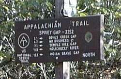
traffic. A nice ride. I crossed the Appalachian trail at about 11 AM, and
got to Erwin TN about noon.
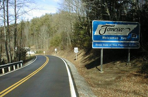
I rode through Erwin to a Subway which is less that a block past the
start of TN 395, the road over Indian Grave Gap. This is a steeper and
somewhat shorter route to a higher (3500' vs 3250') gap than Spivey
Gap. After lunch I rode back to NC on 395 which becomes 197 in
NC. Nice riding, but it sustains 7 to 8 % grade for several
miles. This climb is, however, gentler than the one to Iron Mountain
Gap which is another 20 miles further north on the same ridge. I rode
over Iron Mountain Gap coming home from my summer '99 tour.
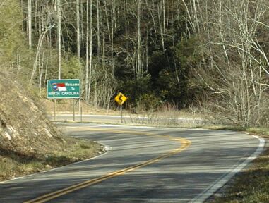
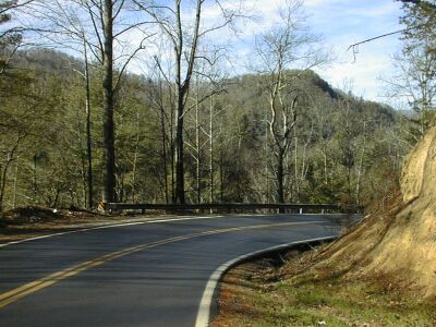
After crossing into NC, there is a steep
descent to 2500' and then a climb followed by a descent to 2200'. Then
comes another big climb, somewhat up and down, but peaking at 2700
feet. Then 197 drops back down to the South Toe river and climbs
gently. I stayed on the river when 197 headed away from it.
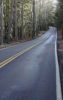
I don't know what the road I took is named (no signs!) but
it crosses the river at Relief NC and continues along it through Green
Mountain and intersects 197 shortly there after. This route is
essentially flat while the section of 197 it avoids is quite hilly.
Speaking of hilly, I rode the last 8 miles to Burnsville, NC on 197. I
also climbed more than 1500' feet in that 8 miles, peaking at over
3200' shortly before a steep descent into Burnsville. Jacks Creek Rd,
which I could have taken instead of that last 8 miles of 197, is much
flatter. It intersects the unnamed road between Relief and Green
Mountain.
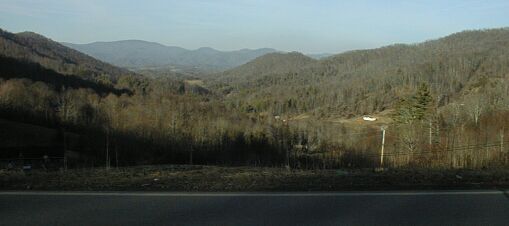
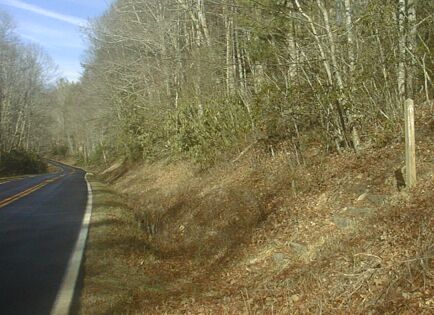
The valley which 197 runs through
When I go to Burnsville I ate a second meal at another Subway: cheap,
reasonably healty, fast food. I'd ridden 70 miles and climbed more than a
mile. I was tired, so I considered spending the night in Burnsville, but
decided to ride the remaining 35 miles to Asheville. That takes about two
and a half hours riding via Paint Gap. I left at 4:10, sunset was before
5:30, and I got home at 7 PM. I had covered 106 miles with a riding time
of 8:37.
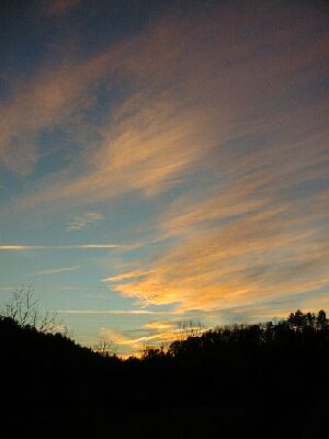
Sunset from Paint Gap Rd
I had some trouble with cramping that slowed me down a little, but most
of the extra time between Burnsville and Asheville was used taking pictures
of a really beautiful sunset. I rode the last 15 miles in darkness, and
the car headlights were a pain, but the rest of the ride was pretty good
even after dark. The temperature was still pleasant - it was 50 degrees
at 10 PM on January 2nd.
This was a pretty incredible ride for January. My first tour in a year
ending in 000 (!) and my first ride over 100 miles in a January.