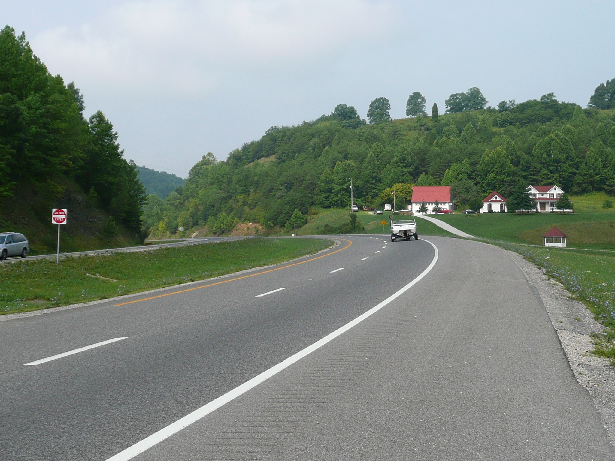
US 23 south of Ashland Ky is noisy, but good, riding with a great shoulder and lots of pretty like this farm
US 23 south of Ashland Ky is noisy, but good, riding with a great shoulder and lots of pretty like this farm
I tried to ride from Greenup to Pikeville today, and failed because of the heat. When I left my room in Greenup at 7:30 this morning, the temperature was already 73 F. It had climbed to the mid 90s - my thermometer read 95 in the shade and 107 in the sun when I suddenly developed heat exhaustion symptoms about 1 PM this afternoon.
I'd stopped to take a break because my knee was hurting and, when I stopped, I noticed that, even in the shade, I was hot. I got my RC cola and a honey bun and sat on a bench, in the shade. A fellow spoke to me about how it was too hot for me to be riding and I assured him I was OK, but when I did my voice was weak. When I went to ride on, I discovered that I had to go to my granny gear to get up a hill I should have been able to handle in my middle ring. I made it to the top of that hill and was able to cool down on a long, gentle, down hill that followed, but I did not feel well and was having to breath hard just to support a modest power output.
I had almost exactly the same sequence happen in up-state New York on my 2007 tour. I was riding, feeling fine, in similar weather and hill conditions and, after I stopped for a break at a service station, I was suddenly very weak and had a hard time going on. That time I got a ride to a convenience store, drank a quart of Gatorade, and continued at very reduced level of power output. The next morning I was still weak - I remember that packing my panniers winded me! - but I was able to ride a gentle route - through the Brook-shires - that day and was able to ride normally the following day.
Today I just headed for the nearest motels on, or near, my route. They were about 10 hilly miles away, which took me an hour to ride. I checked in to the Days Inn in Paintsville, having ridden 73 miles and climbed 1700 feet, and I have been taking it easy since then. I hope I'll be able to ride almost normally tomorrow, but I'll start out by just taking it as easy as I can to Pikeville which is about 40, moderately hilly, miles away. If that works OK, I'll try to get into Virginia, but that requires some serious climbing - the high point on this trip in Ohio, Kentucky and Virginia is at the Kentucky - Virginia border.
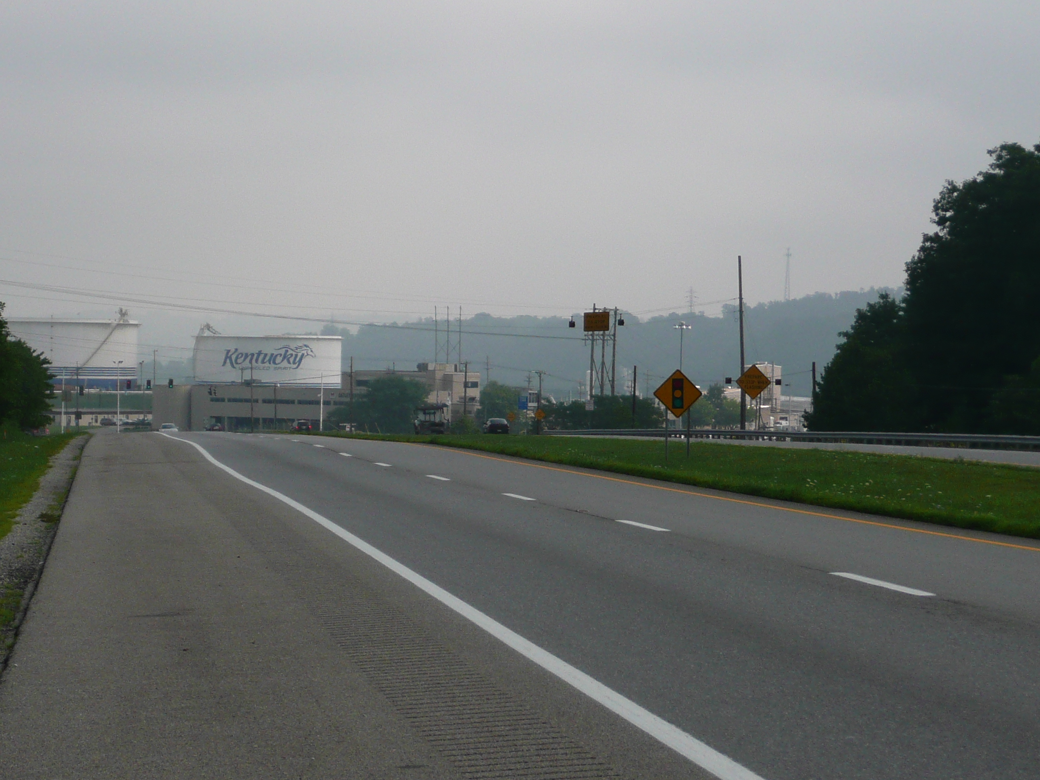
The Ashland area isn't too pretty with lots of oil industry related stuff like these storage tanks next to I-64 at the south end of the area
My first 20 miles of riding this morning was to, and through, the Ashland area. Since I was riding at a high traffic time - I reached Ashland itself at 9 PM, but the worse riding was in the towns before Ashland - in a congested, industrial, area, that riding wasn't much fun. It would have been a lot easier if I had had decent shoulders to ride on, but the shoulder is either absent or almost totally covered by a rumble strip over that entire 20 miles. Driver were polite and I never felt in danger, but it was far more stressful riding than the next 50 miles.
But the view, and the riding, is much nicer looking south
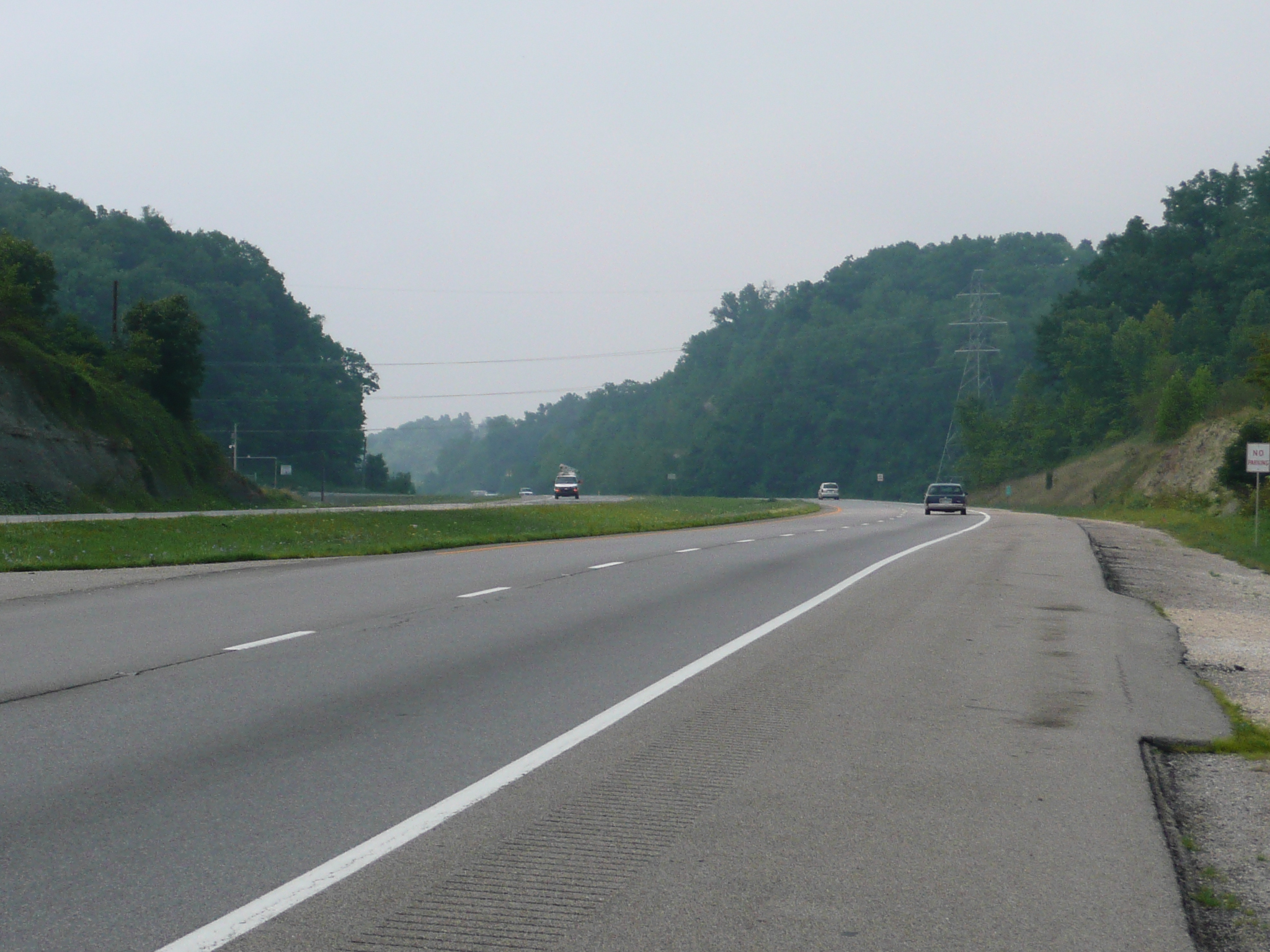
Once past the Ashland area, 23 is a moderately busy, divided four lane, highway with, except for one small section, great shoulders. There are a lot of big coal trucks on the road - semis with 40 foot long 10 foot high trailers that look like wheat trucks except that the trailers have triple rear axles to handle the weight of coal - and a good number of regular semis, so it isn't peaceful, but the wide shoulder, with a gentle rumble strip on the inside, makes it easy to ride. The noise level doesn't approach interstate shoulder noise levels, so I don't feel a need to protect my left ear with an ear plug, the road is hilly enough to provide a lot of variety, but not so hilly as to be hard to ride, and the scenery is pretty enough to keep the ride enjoyable.
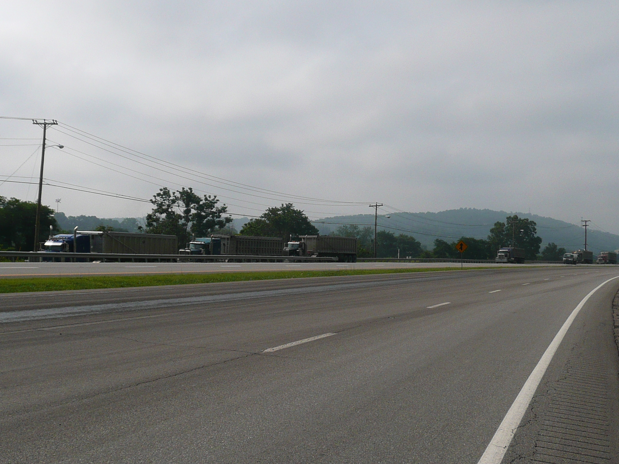
There are a LOT of big coal trucks
carrying coal from mines to power plants on this stretch of road

Most of this part of US 23 is flat enough
to have railroad tracks running along side it
But the flat
stretches, which run in the bottoms of valleys,
are connected by
hilly sections that climb over the ridges that separate the
valleys
Ahead of me are three empty coal trucks 'convoying' south
to get more coal
I measured about 250 feet of climbing per ten miles on this ride. That is a quarter the climbing on the, very hilly, Blue Ridge Parkway. Before I got sick, I only had to use my granny ring on one hill. Of course that was the hill I climbed right after my 11 AM lunch at the Wendy's near Louisa ;-}. There is a fancy collection of services there, about 20 miles south of the end of the Ashland area, because two major roads intersect there. The east-west road runs in a valley and the north-south road descends into and then, almost immediately, climbs out of the valley. It is a long way - 40 miles? - after that to the next place on 23 where you can eat a meal.
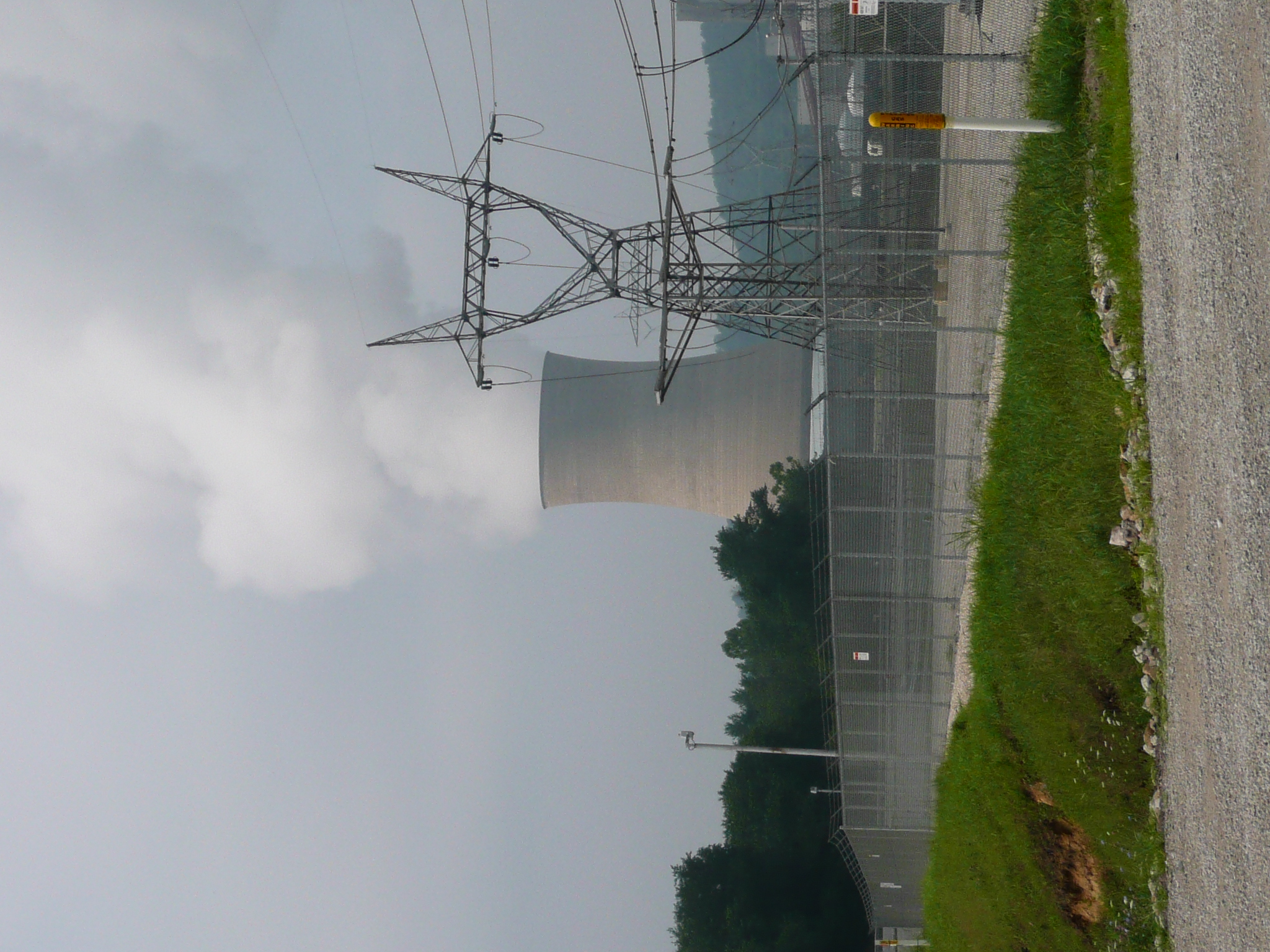
One of two large
cooling towers at the big coal burning power plant in the middle of
this section of US 23
The power plant must have been running full
power since both of the towers were creating large amounts of
steam
Tech note: I took this image from across the road, hand held,
with a 420 mm focal length at 1/160 sec, and cropped it heavily
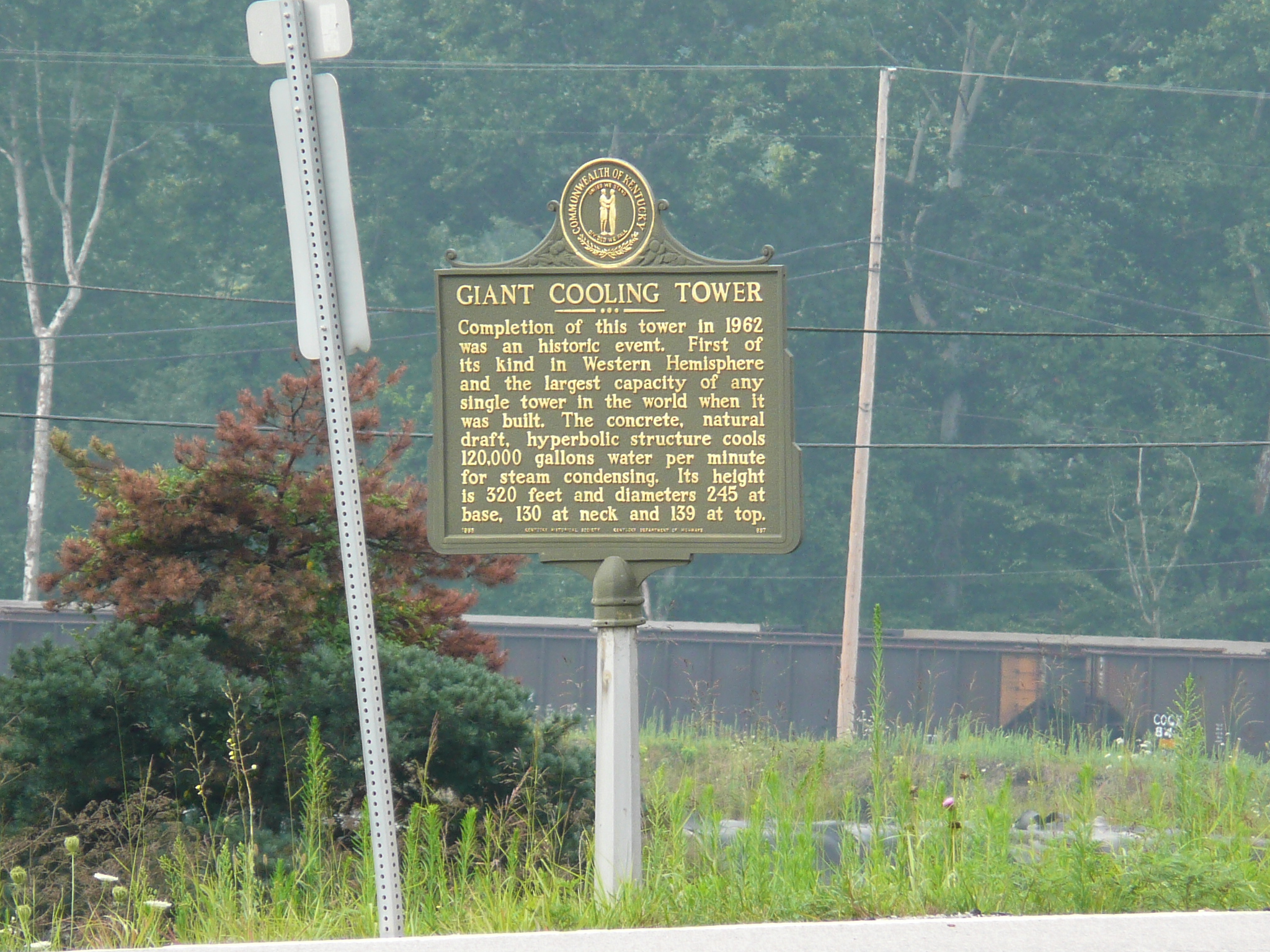
The most interesting things in this section, for me, are the cooling towers at the big, coal fired, power plant in the middle of it and the strata of rock, and coal, exposed in the many cuts required to put this big road in the narrow valleys and route it over the ridges. The first time I saw the power plant, I assumed it was a nuclear plant because of the cooling towers. Then I saw the plant and read the small plaque that says one of those huge towers was the first of its type to be built in the US and had the largest cooling capacity of any cooling tower in the world at the time it was built in 1962. Today, those towers were both operating at what looked like full capacity, sending towering columns of steam high into the, hazy, air.
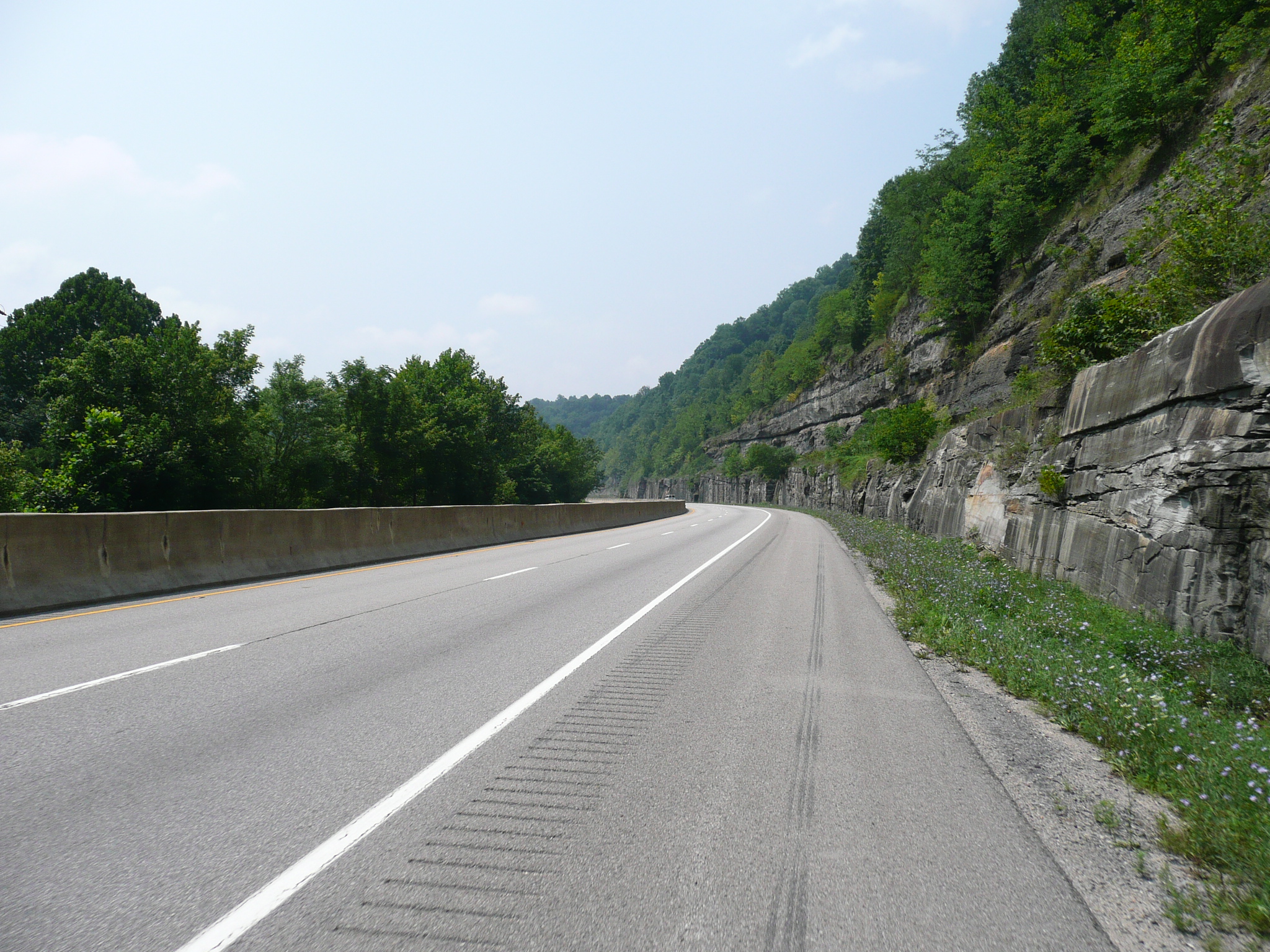
Some of the flat sections, and all of the hilly sections, have large 'cuts' exposing rock and coal layers
Paintsville isn't actually on 23, and my motel is about a mile and a half away from where I left 23, but the road it is on roughly parallels 23 so I hope I can get back on 23 tomorrow without too much extra mileage or climbing. I had supper tonight at a Chinese Buffet because it was the nearest restaurant to my motel. It was right hot out there an I wasn't handling the heat well. Paintsville isn't exciting, but the valley it is in is quite steep sided and pretty and there is a state park and a lake just south of here. If I had a broad band connection, I'd check out the climbing on the routes out of here, but I only have a modem hook-up here. Speaking of modem ISPs, I paid $30 to www.dialup4less.com for three months of service this summer and it has been quite useful with local numbers in almost all of the small towns that I stayed in on this tour.


