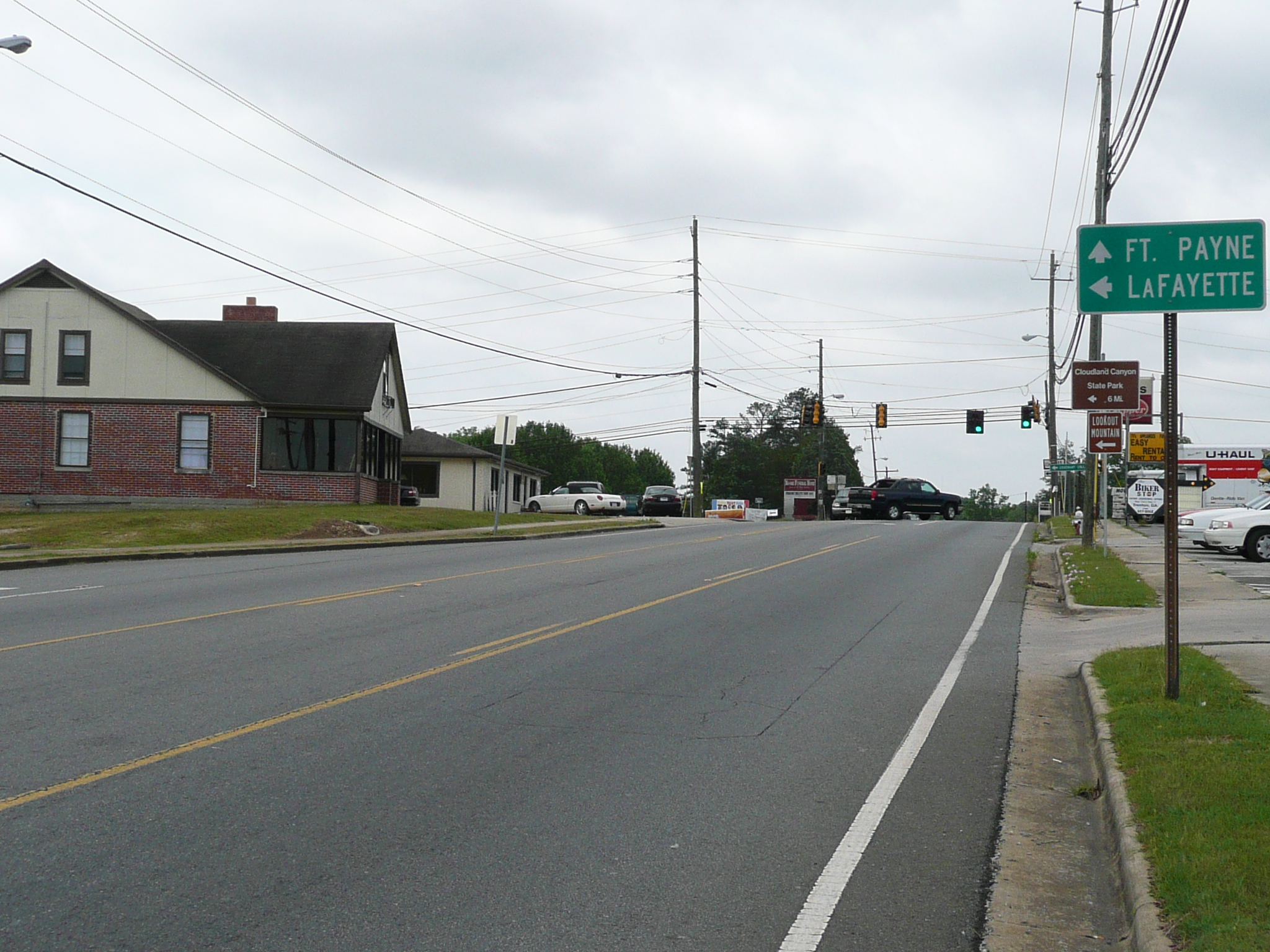
Heading south on US 11
We, my wife Barbara and I, drove from Chattanooga to Trenton GA, so I could start my tour away from 'big city' traffic. To be fair, Chattanooga doesn't have bad traffic, but Trenton has much less traffic ;-}. I told my wife to drive down I-75, but that was the wrong interstate. We need to go down I-59, which goes toward Birmingham, not I-75, which goes to Atlanta.
I realized my mistake soon after we got into GA, and, using my GPS, we got to Trenton on back roads which run south of Lookout Mountain. It was a pretty drive and, since it climbed up quite high above Trenton, it provided me with a good view of the country west of Trenton, I decided I did NOT want to route through those hills, so I left Trenton heading down US 11, a route I have used before.Heading south on US 11
Shortly after leaving Trenton, I had to stop and fix a stiff link in my new chain. I thought I had tested it adequately when I put it on, but I was wrong. This was not the last time I discovered I was wrong today ;-{. Riding on 11 was good with light traffic and a moderate amount of climbing. I measured about 500 feet of climbing in the first 15 miles.
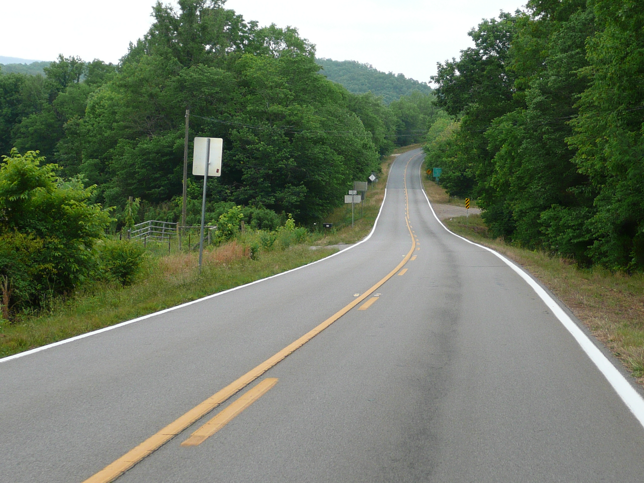
The pavement changes - it becomes darker and rougher - at the Alabama border
11 leaves GA and enter AL after going through on of my favorite named towns, Rising Fawn. It is a nice little town with, I think, a lovely name. In AL, I rode 11 to Hamondville, and then took a connecting road over a ridge and over I-59, to connect with AL 40 which runs to near Scottsboro. I stopped at the service station at the I-59 exit to snack. Then I discovered my first problem of this tour: I had to 'run' to the bathroom. That problem is still with me tonight.

Climbing on AL 40
The first five miles of AL 40 climb up on a plateau. There is over 600 feet of climbing, much of it steep enough for me to be in my granny gears, in that section. There was also a lot more traffic on that part of 40 than on 11, but 40, unlike that section of 11, has good shoulders almost all of the way. It was nice riding except for my tummy discomfort.
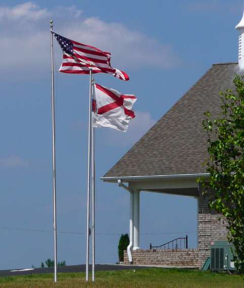
Flags on the Plateau
After getting on the plateau, 40 has rolling hills mostly involving climbs of less than 100 feet vertical. The plateau is a pleasant, agricultural region. It was also rather windy today. I measured a total climb to my destination today of 1600 feet in 50 miles of riding. for comparison, the Blue Ridge Parkway has about three times as much climbing.
40 comes down off of the plateau with a steep descent - it says 13% for three miles, which is impossible since it only loses about 700 feet coming down to the Tennessee river where 40 ends. 13% for three miles would be more than twice that change in altitude. However, it is right steep at the start of that descent, and my speed was over 40 mph on that stretch. At the end of that stretch, the passenger in an SUV which followed me down it told me 'a bag' had fallen - been blown - off my bike. I thanked her and stopped to check to see what was missing. I concluded that it must have been an empty plastic bag from my rear pannier. When I got to Scottsboro and checked into a motel, I discovered that I was wrong, big time.
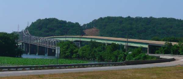
Old and New Bridges over the Tennessee
Getting to Scottsboro, after 40 ends at the river, requires riding over a big bridge which has, on the section going west, very wide, but rather dirty shoulders. There is a much older bridge for the lanes going east and, as I discovered later, that bridge has narrow lanes with no shoulders. After the bridge, the road is expressway like with, except of half a mile or so right after the bridge on the Scottsboro side, good shoulders.
In Scottsboro, I stopped to use my GPS to find a place to stay. I stopped at a church because the building provided some shade and used the GPS to figure out how to get to the first motel I wanted to look at. Then I ran across the street to some woods, too late, and had a strong reason to find a motel soon. The first motel wasn't up to even my low standards, but the second motel I checked - a basic Budget Inn with $30 rooms - was OK and I checked in. After I cleaned up I discovered that the bag that had blow off my bike had come from one of my front panniers - I've never had anything blow out of an Ortlieb pannier before - and contained my cables (ethernet, phone, and USB for charging the GPS), my SD cards (five of 'em!), my neat new wireless US mouse (the mouse pad on this computer is broken), the SD card reader I use to get pictures from my camera to the computer, and the charger for my camera's battery. And a few other, less essential, things.
All this stuff was probably long gone and/or run over, but I decided I had to ride back and look for it. It was about ten miles and 700 feet up to get back to where it had blow out, so I took my bags, other than the handlebar bag, off, dressed in clean bike clothes, and headed back. It was a hard ride, and it got harder when a nail went through my rear tire about half a dozen miles from the motel. I decided to push the bike the rest of the way up the hill, then fix the flat - I had a pump, tire tools, and a patch kit in the handlebar bag - and ride back down, with or, more likely, without the stuff I had lost.
I had been riding hard and now I was pushing hard and in a mile or two, I getting near exhaustion, so I stopped to get a rest and fix the flat. I picked a grassy area to work in and inverted the bike to take off the rear wheel. Then I removed part of the bead and tried to find the two holes made when that long nail went in through the tread and out through the sidewall. I was working in a noisy - lots of traffic - and windy area, so I couldn't find them. I pulled the rest of the bead off and pulled the tube completely out, but I still couldn't find those big holes! Then I decided to remove the tube from the wheel and discovered that the pump head had broken the valve stem ;-}. There was no way I could fix that tube!
Being stubborn, I continued pushing the bike until I got the top of the plateau. That is when I discovered my second big mistake. I had ridden/pushed up the wrong road. Now I was ten miles from my room with a bike I couldn't ride and had wasted a lot of time and energy because of a yet another mistake.
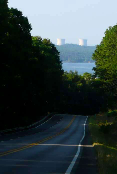
Cooling Towers seen from near the bottom of the hill as I walked down late in the day
I headed down the hill, pushing my bike. That was a lot easier that pushing it up the hill, but not great fun. I tried hitchhiking, but no one would stop, so I walked about five more miles back to the river. In the middle of this walk, I had to toss my bike over the guard rail and run a little ways down the slope. This time I didn't have any toilet paper with me so I soiled another pair of pants, although not nearly as badly as the first pair. You might think I was not having a good time, but, other than the runs and the annoyance that no one would stop to help, I enjoyed most of the walk down the hill. However it was getting late and there was still five miles, or about two hours, pushing the bike to get to my room.
I was enjoying the walk, but I was out of water and getting dehydrated. Obviously the runs didn't help with that problem. I remembered a store/gas station on the river near the bottom of the hill. It is called Foothill Store and I very happy to get there. I had a hard time talking, because of dehydration, but I managed to tell the lady that owned the store that I'd really appreciate a ride back to town. Then I had RC and a snack, ran to the bathroom again, filled my water bottle, and started to walk on. She called me back and told me to put my bike in the back of a black pickup and that a fellow who I'd talked to would give me a ride. It turned out to be her pickup and the fellow was her boyfriend. That was a nice ending to a rather frustrating afternoon.
I got back here in time - 7 PM, I'd originally got here at 4 PM - to get supper - with runs - and to write this ride report. Supper wasn't too good, but perhaps that is OK since I brought enough of it back here to serve as breakfast tomorrow, Sunday morning isn't a good time for eating out in Scottsboro. If I go down to 72, I might find something open.
I hope to ride through the Huntsville area tomorrow and stop in Athens Al which is sort of the eastern edge of the Huntsville metro area. I hope Sunday traffic will be light and I'll be able to ride US 72 which is an expressway between here and Athens. after Athens, it becomes a regular highway. I have alternate routes planned, but those require using my GPS and I'd rather save its remaining battery power for later use. I'll see how things look, and my tummy feels, tomorrow morning after I replace that tube.
If it wasn't Sunday, I could probably replace some of what I'd lost here or, more likely, in Huntsville. The only really difficult thing to find should be the battery charger. Unfortunately, Panasonic has gotten into using unique batteries/chargers for many models, including the TX3. If I had a broadband connection and a USB mouse, I could order one on the net. Right now I have neither of those things.