
Heading down to Silver Lake at 7300 feet
Heading down to Silver Lake at 7300 feet
I rode about 54 miles today. It took eight hours of actual riding because there is 8000 feet of climbing in those 54 miles! I've climbed more than that in one day on my racing bike, but I don't think I've ever climbed that much in one day on a loaded - about 90 pounds bike with bags - bike before. There was some extra challenge because the last 3500 feet of climbing and 30 miles of riding were without services and lack of road signs made it hard for me to tell if I had five miles, or fifteen miles, left to go when I stopped, at 7000 feet, for my last food break. It turned out that I only had another hour of riding to reach Silver Lake, but I was eyeing the sides of the road looking for good places to wild camp if I couldn't reach Silver Lake before dark.
Although I didn't how where I was, I was well informed each time I reached an altitude that was a multiple of 1000 feet. I took picture of signs that started at 2000 feet - I started at 1200 feet in Jackson - and went all the way to 8000 feet. I missed the sign in my picture for 6000 feet! The reason I say 8000 feet of climbing is that there was more than 1000 vertical feet of downhill on the way from Jackson to 8000 feet. That isn't very much downhill for 8000 feet of uphill, but every foot that I coasted down, I had to climb up again! Oh my aching legs...


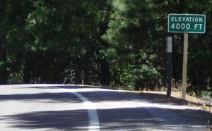
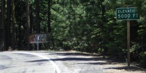
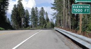
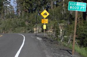
The Elevation Signs
I got up at seven this morning, wondering if I should attempt the long climb today. I really didn't feel well. I think this was a hangover from the heat making me sick yesterday. I decided I'd give it a try since I knew that there were places to stay 20 miles down the road. If I wasn't up the the whole ride, at least I could get to where I had planned to stop yesterday.
I coasted 300 feet downhill into Jackson - that was in half a mile so it was a steep hill and I had no trouble keeping up with traffic on 88. In Jackson I found a good place for breakfast - Mel's Dinner, which I could tell was a good place because everybody in town seemed to be eating there <grin> - and a Safeway store where I could get supplies for todays trip. Since I had no information on what, if any, services existed beyond about 20 miles, I had a big breakfast -The waitress gave me an 'are you sure you can eat a full stack' look - and I got a large loaf of fancy bread and a big jar of applesauce. Service at the restaurant was slow - they were really busy - but excellent and friendly. The big breakfast helped me feel semi human. Everyone was also very nice at the grocery store. I think this is a friendly place except for the jerks who keep yelling and blowing their horns at me on the road...
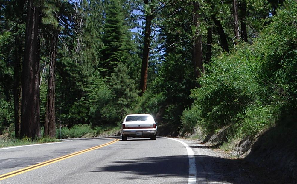
CA 88 usually has a rideable shoulder, but there are stretches with no shoulder
Leaving Jackson, CA 88 runs up a valley with a pleasant creek flowing near the road. It was a good way to start what I knew was going to be a hard day. I rode slowly, knowing that I would be climbing all day. It was about 75 F when I left Jackson a little before 9 AM The woman at the motel had said "It is still cool in the morning.
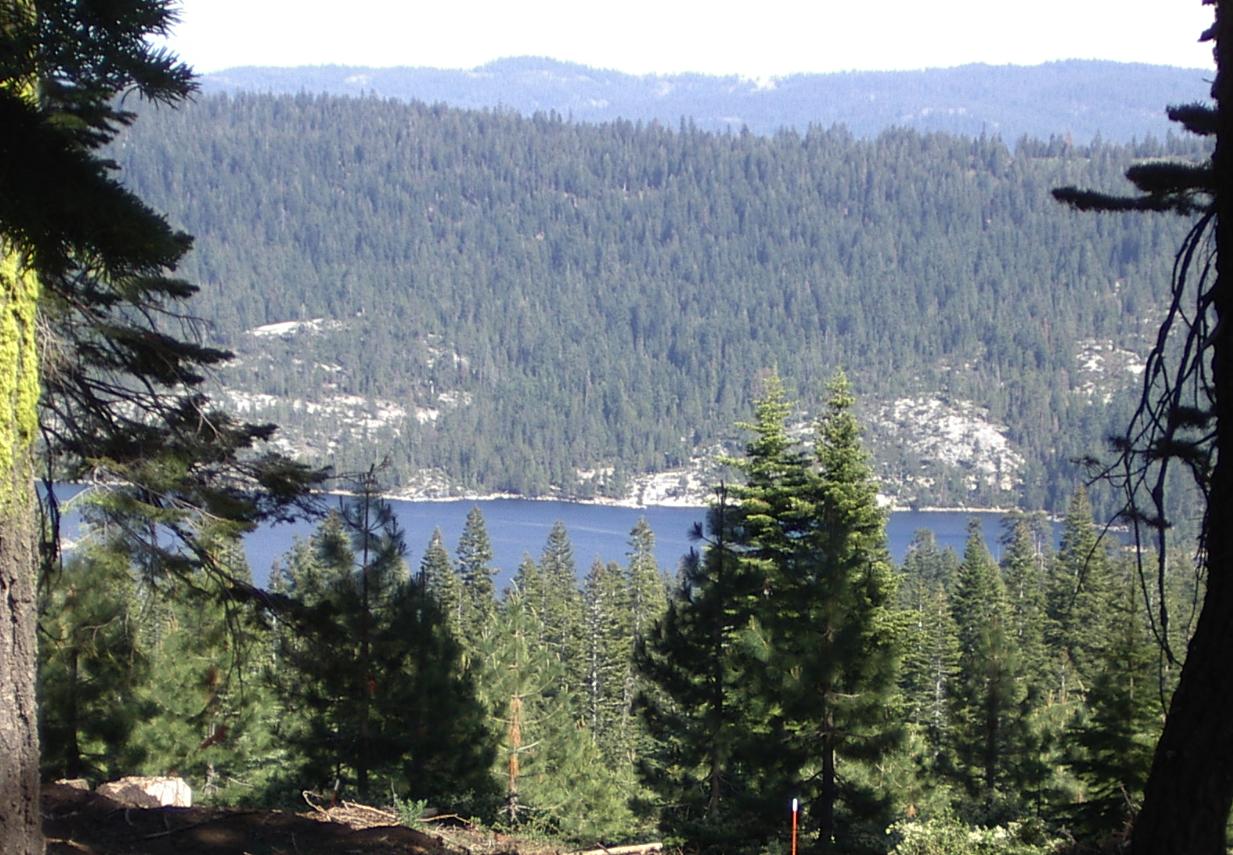
Bear Lake from 6500 ft
When I reached Pinegrove, ten miles east and and hour and a half of steady climbing later, it was 80 F. I don't think it got much hotter than that as I climbed and it did cool off after six or seven thousand feet <grin> .

CA 88 at about 5500 feet
There were services, including places to stay and to eat till just after Pioneer. The last services were two 'stations' which offer food, basic supplies, and gas. One, where I stopped for a late lunch, Cooks Station, is just past the 5000 foot mark. The other station is a few miles further on. I had fish and chips at Cooks. It was good, but a bit heavy and, since 88 does some serious climbing just after that, I had to stop and rest against a tree for a while to give my digestive system a chance to function.

Mt Mokeluma
After the second station, there is nothing, except a national forest camp ground at Bear Lake, till Silver Lake. The distance is less than 25 miles, but those are slow uphill miles. It gets very pretty above 6000 feet and, while you are climbing 6 to 8% grades, you'll have plenty of time to enjoy the views. Well, except when there is traffic. There is enough traffic to require focus of riding, rather than looking, especially in those sections where there is no shoulder. The traffic is mostly cars and pickups, but there are a few RVs and quite a few hay trucks. Those hay trucks are semis with double trailers hauling hay from Nevada to California and going back empty. They are big trucks and, when loaded, they'll give you a big air blast as the pass.
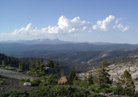
Looking north from about 7000 feet
When I finally (!) reached the 8000 foot sign, I was distressed to see a downhill grade warning sign right behind it. I though I only had 600 feet to climb to Carson Pass, but there was a 700 foot downhill to Silver Lake and, I have learned, there is another climb and descent before the pass. Oh well, what is another few thousand feet of climbing?
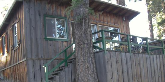
My cabin with my bike on the porch
Reaching Silver Lake meant looking for a place to stay. The third, and last one, here was open and. with a little difficulty, found a room for me. The 'room' is a cabin and I had breakfast this morning with the employees - most of whom are university students from central Europe. It was fun to visit with a Romanian from near Arad where I bicycled last summer! The resort is the Kit Carson. It is on public land, having been here almost 100 years, and is totally off the grid. A beautiful, peaceful place. They get a lot of bicyclists; four so far this year and they have only been open for a week. It is a good, if a bit expensive ($90 was my special rate), place to stay.