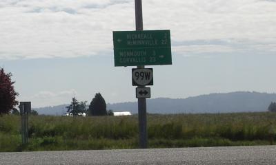
99W, lets head for Corvallis
I left Dallas by using the Monmouth Cutoff which intersects 99W half a dozen mile south of Dallas and three miles north of Monmouth. 99W goes south through Corvallis, so I figured I would stop there for lunch. It took me just over two hours to reach Corvallis, a distance of 30 miles. 15t mph cruising is right fast for loaded touring, but 99W is pretty flat and I had a bit of a tailwind. The shoulder is good to excellent - as big as a car lane in some places - all the way to Corvallis.
In Corvallis, I left 99W to find a burrito place and returned, maybe 15 minutes later - fast food, burp - to continue south on 99W. I have ridden through Corvallis before, but I hadn't ridden 99W south of Corvallis. It isn't nearly as nice as 99W north of Corvallis! Still, it is flat an it does have a rideable shoulder most of the way to Monroe, where it heads southeast towards Eugene and I continued south toward Vaneta on the Territorial Highway. 99W is the Pacific Highway, but I don't know a number for the Territorial Highway. It doesn't have one on my mapping software and it doesn't have any number signs on the highway. Strange.
I was getting extremely bored on 99W after 50 miles of mostly flat, mostly straight, road. It isn't easy riding when you are bored even if the physical act of riding is easy.
Riding the Territorial Highway was, because it was hillier and more curvy than 99W, much easier than riding 99W. I rode it for 20, quite nice, miles, until it intersected highway 126.
When I reached 126, I had ridden about 70 miles and I still had 50 miles to go. I stopped to eat good pizza and to get some apples. I already had, thanks to my hosts in Dallas, bread, cheese, and cookies, so the addition of apples completed the bicyclist's food groups
The first few miles of the ride were flat, then 126 started climbing and was hilly, almost mountainous, for the next half a dozen miles. The hardest hill was big enough, and steep enough, that I could smell hot brake pads at the bottom. It seemed like the maximum grade was about 7 or 8% and even that hill was less than 500 feet vertical. I reached 40 mph coasting down the other side. After Taylor - there is a small restaurant/ coffee shop there - the road was much flatter for
about ten miles. Then it climbs again till it reaches a tunnel. That tunnel is about 20 miles from Florence. The tunnel, and the next mile or so of road, is a moderately steep downhill, marked as 7%, and then the road flattens out into a gentle 1 or 2 % grade till Florence.
I stopped to eat again to eat just before Mapelton. I had come 100 miles at that point and I needed food and, even more, coffee, to be able to complete this ride. It wasn't easy to keep cranking, but it did get faster as the sun went down and the headwind died. I was able to sustain about 15 mph for most of the last hour.
I stopped at the first place I came to <grin> , a very peaceful B+B. It costs too much money, but the view of the river is great, the level of service is nice and the atmosphere is peaceful. I'm not sure i'll be able to get this ride report out tomorrow since I don't have a phone to use, but I am sure I have a good breakfast. Breakfast isn't till 9 AM, so I hope to sleep till 8:30. my body is aching - even with Aleve - but it was a good day's ride and I'm pleased that I was able to do it. Tomorrow's ride will be shorter...