Day 29: Landeck, Austria to Naturno, Italy
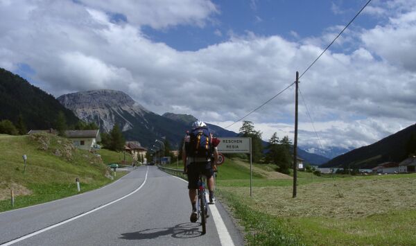
This is the town the pass is named for - Resia in Italian and Reschen in German
The sign, in both languages, shows we are in the German speaking part of Italy
Today was my first rainy riding day - after more than a month in Europe - and the first day on this tour that I rode most of the day with another tourist. The rain started about five miles from Landeck and lasted till Nauders, the last town before the Italian border and the pass over the Alps. During the rain, I met and visited with two riders, one was on a racing bike and carrying nothing more than a rain jacket. Since it was in the 50s and raining, I figured he must be cold, but he seem to be having a good time. Shortly after talking wth that rider at Tösens, I saw another rider ahead on a bike with an umbrella! I figured it was a local person and expected to pass them soon. They kept up with me pretty well on the climbing, but I was definitely faster downhill - MTB knobby tires and umbrellas, have a lot more rolling and air resistance, respectively than touring tires and rain capes. Actually I'm not sure that is true - the air resistance of a rain cape is pretty high! It took longer than I expected to catch that rider, and, when I did, I discovered that he was a German tourist riding a cheap MTB and the umbrella was mounted to his back pack.

My German riding companion
While I was cranking along in the rain, feeling perhaps a little sorry for my soggy state, but basically comfortable with
my rain cape and high tech clothing, he was riding in rather low tech clothing, with an umbrella providing some protection from the rain! His bike cost less than my pedals, and his gear was in a backpack while mine was in four, waterproof panniers. Despite all of this he was riding at a pace only a little slower than mine. He seemed to know where he was going, so I started riding with him. We rode together for the rest of the day and will be riding together again tomorrow, then he'll be taking the train back to Austria and I'll be riding on towards Slovenia. He is in Austria for a film festival - he works in the film industry - and improvised a three day tour using what was available. I think he did really well.
I took pictures before the rain got serious and again after we had stopped for lunch in Nauders. The weather cleared up while we were eating. However, before that it was just too wet use my camera, so I couldn't photograph the prettiest part of the climb. I even looked for shelter where I could take the camera out without exposing it to the rain, but didn't find any.
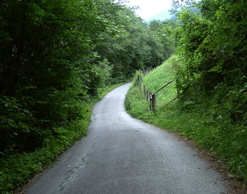
I took a bike path from Landeck to near Fliess
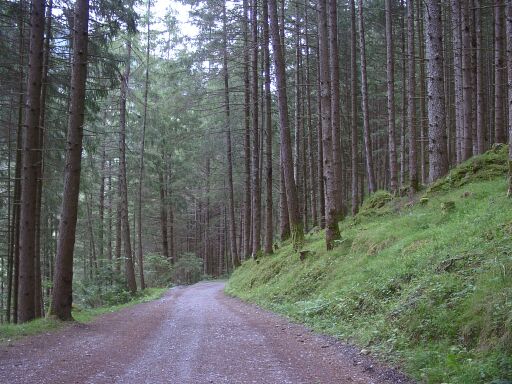
Much of it was in the woods
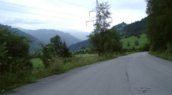
Then, before Prutz, there was a road across the river from B 315
It was very pleasant riding just before the rain
The pass was easy. As Ralf, my German friend said, it shows Hannibal was smart. This is the route he chose when his army, complete with elephants, crossed the Alps. It was a remarkably easy ride trough the Alps. I noted later that that the next pass east is Stelvio famous for its difficulty. Climbing Reschen Pass from Landeck required less climbing than getting to Landeck from Farchant!
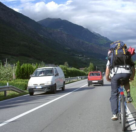
Traffic in Italy was heavy, as was traffic going over the pass
The hard part of the pass was before Nauders and after the bike path went away where B184 and N315 split. It wasn't really hard climbing, but the road was narrow, curvy, and had guard rails between us and big drop offs on the outside where we were riding. It was raining intermittently and the traffic was heavy and include a lot of big trucks and buses. This was not relaxed riding, but the drivers were good and were not in danger as long as we could hold our line. There was one long tunnel where we lucked out with light traffic. Even with the light traffic it was incredibly noisy in that tunnel. I could hear thing, especially motorcycles, coming for many minutes before I could see them.
When we reached the top of that part of the climb, we stopped for lunch at a restaurant in Nauders. That took more than an hour, mostly because we were having such a good time talking, and the weather cleared up while we were there. It was the first time we had see the sun that day and it was nice to dry out. When we crossed the border between Austria and Italy, we officially reached the pass, but, in reality, we climbed another 50 M or so and then maintained that altitude for half a dozen miles. That was really pretty, going by the lakes at Resia and a couple of small towns. Then we made a steep, windy descent. I am very thankful I did not to have to do that descent in the rain!
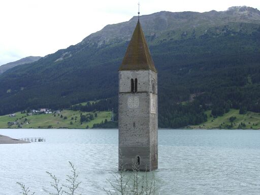
Where there now is a lake, there used to be a part of village at Resia
The church steeple is all that is left of it
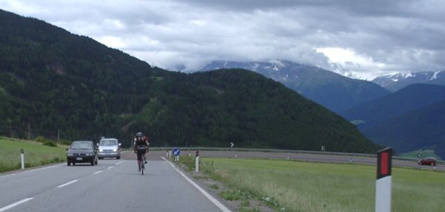
Heading down towards Stelvio National Park - this is the start of the switchbacks
Riding on top, heading south, was very fast, in part because we had a good tail wind. The descent was a series of switchbacks which made that tail wind a strong cross wind. Each time I turn across the wind, I'd fight to keep my bicycle in my lane. Ralf's MTB was considerably slower than my touring bike on that steep descent, but I stayed behind him, in part because it wasn't safe to pass, but also because I was afraid of losing control of my bike is I let it gain too much speed on those steep slopes with that gusty cross wind. I had adjusted the brakes on both my bike and Ralf's bike before lunch, fearing that we would be doing a descent in the rain. Even in the dry, I was glad to have strong brakes. Riding down was fun, if challenging, riding up that steep road into that strong wind would have been really hard!

The bottom of the switchback section, about 500 M lower than the top!
Riding in this part of Italy was, like Austria, pretty much like riding in a different part of Germany. The signs were all in German, the business were the same as in Germany, etc. The biggest differnce was the drivers < grin >! The vehicles come much closer to our bikes, and to each other, in Italy than they do in Germany or Austria. It took a little getting used to, and I still can't believe the bus that passed us, into a blind corner on a narrow road with a rock face on the inside and a guardrail on the outside. Another bus came around the corner in the opposite direction. There might have been half a foot of clearance between the buses and maybe a foot between the bus that was passing us and us. I bet the second bus was also within half a foot of that rock wall. That was a frighteningly tight squeeze.
We rode, down long gentle hills with only occasional uphills, through really dramatic mountain valleys with often heavy traffic, but also some nice long periods of light traffic. It was fun and not stressful after you accepted the fact that most drivers would pass into oncoming traffic. The traffic speeds, by US standards, were slow and the drivers were careful. The weather deteriorated in the late aftenoon, and we had some, very light rain, but nothing that required Ralf to put his unbrella up again.
We stopped for the night at Naturno at about 6:30, and stayed at a very inexpensive (23 E including breakfast for a single room with shower, etc, and breakfast) but nice place. There was a Apple festival going on in town, so we walked down to the festival and had supper there. We got back about 9:30 and I started working on this report. A nice day, despite the rain. About 70 miles and, I'd guess, 3000 feet of climbing. My altimeter seems to be affected by the weather, or maybe its battery is going: It measured over 2000 M of climbing. That doesn't make sense when I started from 700 M and the pass was at 1350 M, only 650 M higher - that is only a little over 2100 feet.