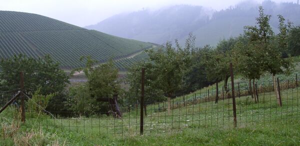
The view from the big hill east of Durbach
The view from the big hill east of Durbach
Getting out of Strasbourg wasn't hard - there are good bike paths along the river - except for the high traffic levels that included lots of big trucks - at the border. Once I got into Germany, it was obvious that my planned route, along B28, was not practical near Kehl because of the traffic on that road. I ended up taking B36 out of Kehl towards Offenburg, and then taking bike paths to Offenburg. At Offenburg, I headed north on B3 - OK bike path - and then east, through Durback, to Oberkirch. This was a major detour, but the ride through the Durbach area made it worth while. This area, although smaller and hillier, is much like the Alsace Wine route. It is also on the edge of the Black Forest.
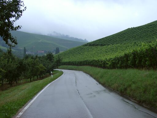
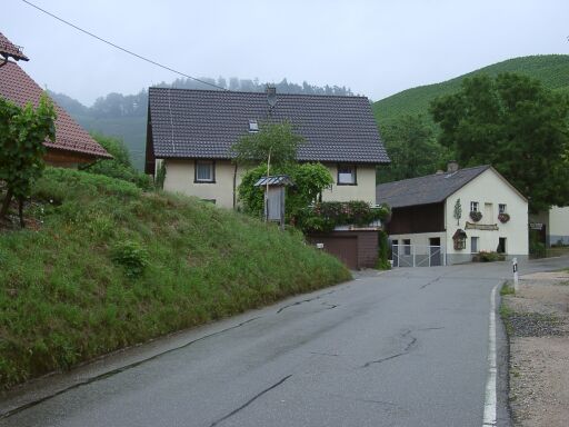
Some images from K5369 east of Durbach
I stopped at a supermarket in Oberkirch to get some supplies and have a snack break, then rode on, on B28, towards Freudenstadt. Sometimes the traffic was a bit much, but it was enjoyable riding - in the rain - up the Rench river valley. Mostly a steady climb that I could handle in my middle ring. At Oppenau, I had the option of climbing over the ridge on L92, but decided to stay on B28 because it was good riding. After Bad Greisbach, I stopped for a break before climbing over that ridge on B28. I wasn't sure how big the climb was, but it turned out to be over 500 meters vertical of steep climbing.
It was signed, at the top, as 6 km of 12% grade. It was close to a 10% average grade over that distance and maintained 12% for several kilometers. It was the hardest climbing I've done since I left the mountains in southern France, and the next steepest climb to Vrsic in Slovenia. The rain, although it meant bad visibility on much of the climb, also made the climb easier by keeping me relatively cool.
From the top of the climb to Freudenstadt, some half a dozen miles later, was almost entirely downhill. That was fun, but chilly. I put my all purpose - mainly rain and dress - shirt on at the top and shivered a bit on the way down. I stopped in Freudenstadt for coffee and a dessert which helped to warm me up, then continued on B28 towards Nagold. This was not as nice riding as B28 between Oberkirch and Freudenstadt because there was a lot more traffic. It was hilly, and wet, but B28 followed river valleys so there were no more major climbs. I made it to Nagold about 6 PM.
I was going to stay in Nagold that night, but, due to a screw up on my part I had no way to get cash, about 20 euros in my wallet and my Visa card. I couldn't find a hotel in Nagold that would take Visa, so I ate a good supper for about 11 Euro and headed towards Magstadt. "A mans gotta do what a mans gotta do," and on this night, I had to to get to my friend Heiner's house in Magstadt to have place to stay.
When I rode north from Nagold on B28 about 7 PM, it was raining and traffic was fairly heavy. Riding was not bad except for the occassional jerk, but it wasn't much fun either. I did get yelled at and have horns blown at me a couple of times by people who, I'm guessing, wanted me off their road and onto the bike paths. The problem was that I didn't know the bike paths and they were not as clearly marked - usually they are not marked at all - as the ones near the border, so I really couldn't use them. Instead I rode an increasingly busy B28 towards Stuttgart. I finally got off B28 at Herrenberg and, using my computer in the rain, tried to find my way to Magstadt. The roads didn't match my mapping software, so I picked a road going to Aidlingen, a town in the right general direction, and rode on. That was a nice new road - not on my map - and Aidlingen was a nice town with few services, all closed. I figured that I could go east from Aidlingen to Darmsheim and then north to Magstadt. I saw a fellow working in his driveway in Aidlingen, so I stopped to ask. He didn't speak English, but was able to help me route to Darmsheim and on to Magstadt. In Darmsheim, I finally saw a sign for Magstadt and, with much relief, was able to follow the signs.
When I got to Magstadt, I looked for an open business, found the Eiscafe Venezia, and stopped to ask them to phone Heiner. The owner knew him, and was very kind and helpful. Heiner lives nearby, so he walked over to show me the way to his home. I had a cup of coffee to warm me up while I waited and life, which had been a bit stressful, was good again. A long day, hard on me and my computer, but with a nice ending.

