Day 55 Morristown Tennessee to Asheville North Carolina
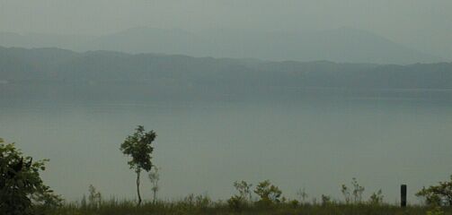
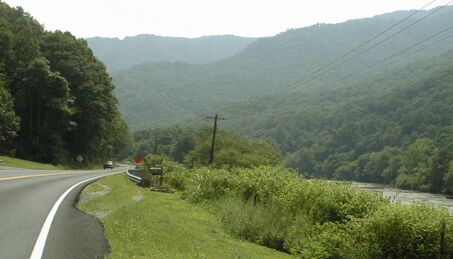
Taylor Lake with Smoky Mountains in haze
I was not pleased with either my room or my supper in Morristown, and spent a indigestion disturbed night in one of the poorer, but not cheaper, Super 8 Motels I've encountered. I was happy to be on the road in the morning, and even enjoyed another McDs breakfast! Seven miles further south on US 25e, just before it reached I-81, there were several motels, including a modern Super 8, and a better selection of places to eat. If I had to do it again, I'd ride the extra seven miles!
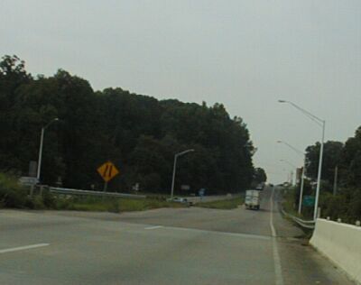
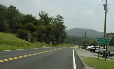
Crossing over I-81 - 25e becomes two lanes with a narrow shoulder
After crossing over I-81 - 25e is two lanes with a narrow shoulder, and fairly heavy traffic. Not great riding, but the riding, if not the road, improves as it goes south to Newport, becoming quite nice riding.
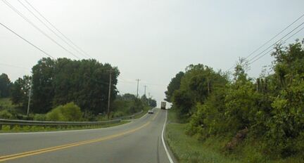
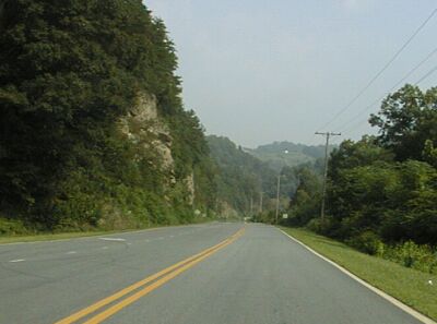
Heading up yet another hill on 25e
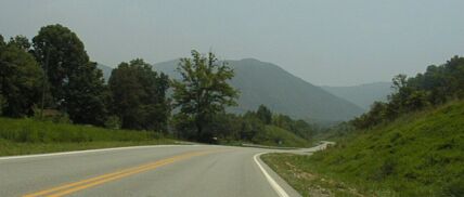
If you fly over eastern Tennessee, you can see how the land is a series of ridges running north-east to south-west. If you look at a road map, you can see that many of the major roads run in the same direction, and a smaller number run across the ridges. 25e is a ridge crosser as was evident riding it yesterday. The road was hardly ever flat, it was either climbing or descending as it made its way north-west to south-east. That is still true with the part of 25e between Morristown and Newport, although the ridges are smaller than they are between Middleboro and Morristown.

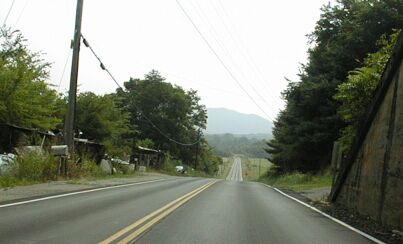
The bridge over Taylor Lake
Another flattening feature in this section is Taylor Lake. A good part of 25e south of White Pine runs along the lake. This makes for beautiful, if hazy/smoggy, scenery and a flat road. There is a still a good sized ridge to climb just north of Newport, but you get five miles or so of pretty, flat riding before that.
In Newport, I stopped at the Coffee Spot Diners for an early lunch. I'm back in familiar country now, and I know that there are few places to eat between Newport and Hot Springs NC, so I eat where I can. I had an inexpensive, good, meal in a very friendly, and very down home, restaurant. Then, suitably fortified with two large cups of coffee, I headed for Hot Springs.
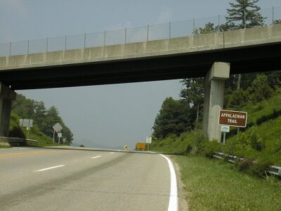
Going under the railroad tracks east of Newport
There is a good climb out of Newport, but then the road passes under the railroad tracks, now 25 with no e, and descends into a valley that follows the French Broad River up its gentle course for more than a dozen miles. This is very nice riding indeed, with little traffic and nice scenery. It also has fresh pavement, although I did run into some paving construction delays. The new pavement runs till Del Rio, then the old, but still quite good, pavement takes you to North Carolina.
US 25 following the French Broad River
Del Rio
A few miles after Del Rio, 25 leaves the French Broad, and the climbing starts. Just about this point I saw a very heavily loaded bike leaning against the front of a tavern and stopped to visit with its rider. He admitted that his bike weighed about as much as he did.
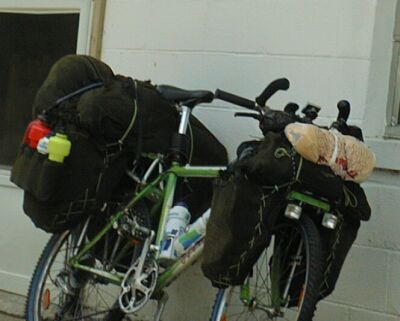
Now that is loaded touring!
He had ridden from Raleigh - that's 300 miles or so - and was headed to California. He was celebrating getting out of North Carolina. We visited while he drank his beer and the bartender looked on, then I departed, cranking on up the hill towards North Carolina. I stopped once or twice to drink some coke and to cool off. It was hot and humid and I had to be careful not to overheat.
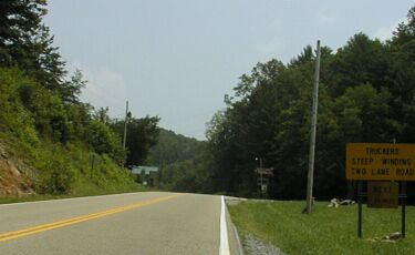
Sign at the NC Border: Steep Winding road next 21 miles
Coming over the border between Tennessee and North Carolina usual means a gap or pass trough the mountains since the border follows the ridge line of those mountains. This is not the case where 25 crosses, so this is the easiest way into NC from TN. You pay for that big time right after Hot Springs when 25 does cross the ridge line at Tanyard Gap. As soon as 25 enters NC, it starts descending. But then it climbs again for a while. Then it descends. Then it climbs for a third time and, finally, descends into Hot Springs. At the bottom of the second descent, my bike got dog bit! It was weird; a little dog, obviously the alpha dog, and a big dog, a rather dumb looking german shepard, came out at me. While I was watching the little dog who was threatening my left ankle, the big dog bit my slow moving vehicle symbol and broke the band that held it onto my bike. I felt the pull on the bike, stopped to see what had been bitten, and was annoyed enough to go at the big dog who looked sheepish and ran way. No real harm was done - I fixed the band in Hot Springs - but he could have caused me to down.
Descending into Hot Springs
In Hot Springs I ate an overpriced lunch at the Kayakers Pub - this town is getting too yuppified! - and then headed for Marshall. It is 15 very hilly miles to Marshall, starting with 1000 foot vertical, 6 to 8% grade, climb to the ridge line.
The ridge line
Then there is a 500 foot, sustained 8% grade, almost straight line descent. I sustained 40 to 45 mph without tucking. That descent is followed immediately by a 600 foot, 4 to 10% grade climb up a twisty bit if road with no shoulders and a good bit of traffic including large trucks. That part isn't as bad as it sounds because the road is so twisty that the traffic isn't moving very fast. Then 25 has rollers mixed in with some pretty good descents for the next five miles, followed by some more climbing. I measured about 2000 feet of steep climbing in the first ten miles. This is hard riding, and it wasn't helped by the hot, humid, sunny weather. I wrung a lot of sweat out of my gloves and shirt at the top of that first climb and wore my vest to keep from getting chilled on the descent.
I wasn't looking forward to this part of today's ride and I can't say that I enjoyed most of it, although it is quite pretty. I just got through it, stopping once for a quart of Gatorade and a big candy bar.
Heading down to the French Broad River at 35 mph
Things improve a lot after Marshall, because you can go down to the river and ride along it on NC 251. This is nice, easy, riding. It is where most of the bicyclists in Asheville go to ride, and usually I find it boring. Since I was already exhausted, I was happy to have easy riding. It is about twenty miles to Asheville and I stopped at a park to have my final snack of this tour. I needed it to have the energy to get home.
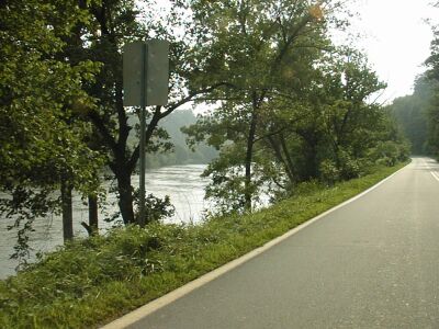
Looking back at the river
The folks you meet riding along the river usually don't ride to/from the river because there are some moderate hills to get over on the way. I got to climb another few hundred feet getting home. Total climbing for the day was nearly 5000 feet.
I had been looking at dark skies ahead of me for quite a while, and hoping the rain would miss me. It didn't. When I started my climb up from the river though Woodfin, it started sprinkling. When I got to Lakeshore Drive a mile later, it was pouring. I had to ride in heavy rain for the last mile and a half. It was raining was so heavily that water several inches deep was running down the road. When I got home, I was cold, wet, and exhausted. It would have been a much nicer day if I could have quit riding in Hot Springs, but I'm used to having the last day of my tours be the hardest day. There are no easy routes into Asheville.