Day 52 Madison Indiana to Harrodsburg Kentucky
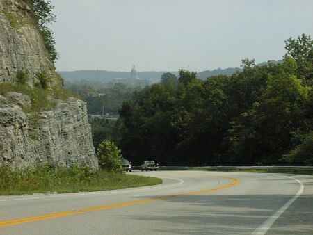
Descending into Frankfort, the Capitol of Kentucky
Today's ride was in two parts: a mostly very rural road, US 421, for seventy miles from Madison Indiana to Frankfort Kentucky and thirty miles on an expressway from Frankfort to Harrodsburg Kentucky. It was about 100 miles of riding with 3000 feet of climbing, we are definitely not on the prairie any more, and most of the climbing was on 421.
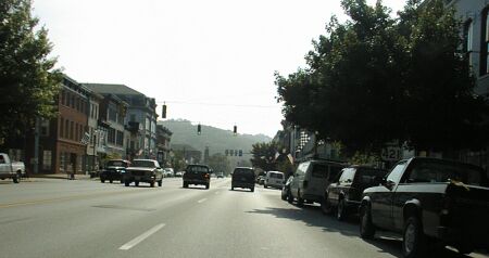
Main Street Madison
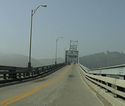
Madison Bridge, which I tried to ride on my tricycle!
I left my motel and rode a mile or so to a restaurant for a good breakfast buffet, then rode down into Madison and over the bridge to Kentucky. It was hot and humid, so my clothing was throughly sweat soaked by the time I had climbed the hill on the others side of the river. I measured 500 feet of climbing in the first five miles, 100 feet or so on the bridge and the rest climbing out of the Ohio River Valley.
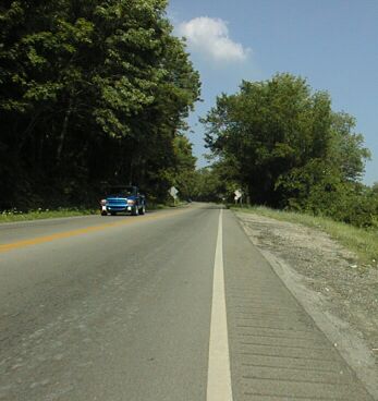
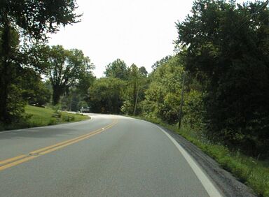
The hill - note the rumble strip ruined shoulder
When I rode off the bridge into Kentucky, I rounded a corner and immediately began climbing. US 421 in Kentucky usually has a shoulder, but it has consistently been rendered unrideable by making it a rumble strip. This was of some concern to me as I climbed that hill at five mph, but I soon saw that it was not to be a problem since the drivers, as in Indiana, were polite. I did get off the road once for a group of three big trucks hauling ass up a fairly steep hill, and there were one or two other times when I would like to have been able to get out of the way, but that isn't bad for five hours of riding without a shoulder.
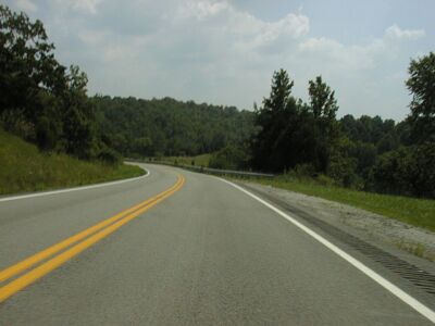
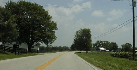
US 421 - nice riding
After the initial hill, 421 was reasonably flat to Bedford, then there was great downhill followed by the inevitable climb back up. The road seems to follow ridges or valley for much of its length, but there were at least half a dozen descents following creeks down to rivers and the ascents following another creek back. Needless to say, these were the prettiest parts of the ride! None of these was a bad as the initial climb from the Ohio River, but most of them required my granny gears and a few of them required my lowest gear. Coming into Frankfort required almost as much climbing to get over a series of hills, as climbing out of the Ohio River Valley. The final descent into town is quite spectacular. Over all, I'd rate US 421 between Masdison and Frankfort as quite a good ride
Descending at 35 mph
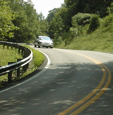
Climbing at 5 mph - me, not the car!
I had planned to stop for lunch in New Castle, but fortunately stopped at a convenience store in the southern outshirts of Milton to clean up and dry off a bit before riding on. I bought two liters of Pepsi there and carried it with me. I did my first side of the road stop before Bedford (about 15 miles) and my second after New Castle (about 30 miles) when I discovered that there was no place to get lunch in New Castle! To be fair, there was a café, but it was closed at 1:15 when I got there. There is a very nice park just south of town and I stopped there for my second snack of the day. There was one open convenience store between New Castle and Frankfort. I was glad that my supplies were well stocked, because I rode for about seventy hilly miles between meals.
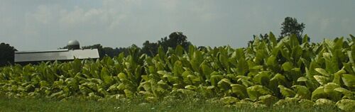
Tobacco
I knew I was back in the south when I saw a real-estate sign that listed Billy Bob Coomes as the agent. However, even before that, the tobacco allotments along the road were a good clue. The fact that the weather reminded me of riding in Louisiana in May, might also have been a factor. To be fair, it only reached 90 F today and the relative humidity, at least in the afternoon, probably wasn't over 75%, so it really wasn't as hot as Louisiana. My shirt did eventually dry, and riding was hot when climbing but pleasant otherwise.
Black fence and Tobacco
There is one peculiar thing about this region: black fences and barns. Even in the towns you'll see black fencing where in most places you'd see white fencing. I have no idea why, but I find it a little strange.
When I got to Frankfort, I saw that there were no services where the 127 bypass crosses 421. Since I didn't want to miss another meal opportunity, I rode on into town on 421. Then I headed south a few blocks and found a coffee shop on Broadway - a renovated part of town - for lunch. Town was neat, but getting out of town was not fun. I looked down Broadway and saw that an old bridge, which was closed to cars, that would take me back across the river so I could ride down the river on the rural side. I could and did, but then I ended up having to ride US 60 west to US 127 bypass. That wasn't fun since there was a big hill, with curves, too much going home traffic and no shoulder. There was a passing lane, and only one car, a van with a handicapped sticker - so maybe the driver was a bit out of it, came really too close to me, but it was bad riding.
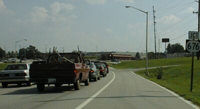
Traffic backed up on 127
I had to get over a lane in heavy traffic in order to turn left on 127 bypass, but a polite driver made that easy for me. While I waited for the light, I put my left earplug in and, when the light changed, hustled on over to the good shoulder on 127. Then I rode, often faster than the rush hour car traffic, south across I-64. This wasn't fun, but it was a lot better than riding on US 60! There were lots of services between the intersection of 60 and 127 and the intersection of I-64 and 127, so, if I were doing it again, I'd either take the bypass and skip downtown Frankfort or cross the river on 60 in Frankfort and then ride south on KY 420 which intersects 127 south of I-64. Downtown Frankfort is worth a visit, but you should minimize riding on US 60.
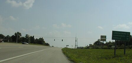
Riding south on 127 -Harrodsburg 24 miles
My original plan was to ride to Danville, which is nine miles south of here, but that was based on Delorme giving 60 miles for the ride from Madison to Frankfort. That put Danville just over the 100 mile mark. What I measured was closer to 70 miles to Frankfort, which put Harrodsville close to the 100 mile mark and Danville close to 110 miles. I show 99.7 miles for the day, but that is really about 97 miles according to my most recent calibration which showed a 2.5 % high reading. Delorme gives 93 miles. I think the problem may be that the curvy nature of 421 has caused Delorme to error on the low side. I know once before, on Four Mile Canyon west of Boulder Colorado which is very curvy, Delorme was quite short on its calculated distance. In that case Delorme was almost a factor of two off.
Riding the expressway was faster and easier that riding 421. 127 has gentle grades and, with a good shoulder, I could maintain a good speed. After 70 miles of 421, I was happy to have easier riding, even if it was noisier - the earplug really helps - and more boring. I stopped for a snack and some US 60 recovery time about 5 miles down 127 and had a nice visit with a local cyclist, then I rode on to Harrodsburg. The shoulder had some problems along the way: there are two railroad overpasses where the shoulder is pretty narrow, and, after the first one there is bad pavement shortly after I got back on the shoulder. I was glad I had the Softride stem. Then, in the ten miles or so after that, there are a few major potholes in the shoulder which meant I needed to ride in briefly the lane, and finally, the shoulder going south just goes away five miles or so north of here! There is still a shoulder going north, and, if traffic had been heavier, I would have switched to the other side of the expressway. As it was, I watched all the approaching traffic in my mirror to make sure there were no problems. Polite drivers, every one of them, meant I could safely ride without the shoulder.