Day 24 Lake Louise to Saskatchewan River Crossing AB
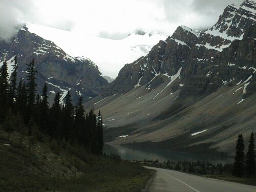
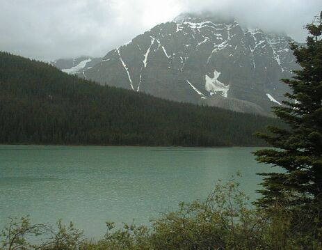
Bow Lake with Bow Glacier above it
I had planned to ride on the Icefields Parkway today and tomorrow. Today wasn't a very good day; rainy and cold, but that was a minor problem. The real problem was the traffic. I talked with several tourists last night at the Lake Louise Hostel, and again with one of them, a Belgian, this morning. He had ridden the Parkway from Jasper yesterday and the day before and was planning to ride to Banff today. We discussed whether he should ride the TCH or the Bow Parkway. I advised the TCH, since it is a faster ride and the two routes are equally scenic. He was worried about the traffic. Riding the Parkway today, I realized that the traffic on the Parkway was actually much worse than the traffic on the TCH south of Lake Loiuse! I was appalled by the large number of tour buses and RVs that were on the Parkway today. The really heavy tourist traffic that starts this weekend must be a nightmare!
Riding the Parkway today, I considered using an ear plug to protect my left ear from the noise from all those buses. Riding the Parkway today, I was struck, almost literally in one case, by the rudeness of the drivers. Riding the Parkway today, I was beat up by its rough shoulder and scared by a long 40 mph downhill with rough/broken pavement and no shoulder. Riding the Parkway today was not much fun, so I'm not riding it tomorrow, but rather riding east along the Saskatchewan River on Hwy 11. Several people had told me highway 11 is almost as pretty as the Parkway and has very little traffic on it. Oh what a relief that will be...

Getting back on the TCH at Lake Louise
I got up at 7:30 this morning after a pretty good night in my dorm room at the Lake Louise Hostel. Since two of my roommates were still asleep, I quietly cleaned up and did some things that needed to be done before heading for the Café for breakfast. When I got to the Café, they were having a special function and asked me to come back after 8. I did get a cup of coffee which I took upstairs to the internet machines intending to send my ride report in and setup the web page I had stayed up late to finish the night before. No such luck. The machines at that hostel - and at the motel I'm staying at tonight, are only expensive web-browsers, and are useless for uploading files from a floppy or connecting to system in order to set up web pages. Oh well, I was able to check my mail and respond to a few emails for $2.
Breakfast was mediocre, expensive, and slow, but it was raining, so I was in no hurry. I visited with the Belgian tourist, finished breakfast and got my bike packed - I had to leave it in the 'Ski Room' unpacked - just at 10 AM, the check out time. Then I rode over to the Grocery store - it was nice - and stocked up for unsupported riding. I left Lake Louise about 10:30. The rain had stopped, the temperature was in the low 50s F (10 C) and it was chilly, damp, and dreary.
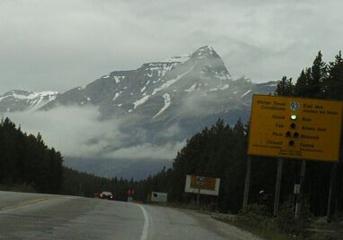
The Icefields Parkway Entrance, just off the TCH
I stopped to visit with a fellow who had just ridden in off the Parkway - he had his pregnant wife driving his SAG - and then rode into the line of vehicles entering the Parkway. I was surprised that drivers seemed more aggressive and more in a hurry than they had on the TCH. As I rode away from the entrance, it seemed more like the start of a race than a ride on a Parkway.
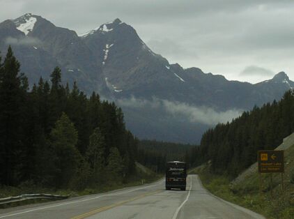
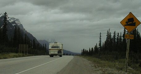
Mountains and a tour bus - I saw lots of both today
The shoulder was good and the road climbed steadily, but not steeply, so I was soon warmed up and got my clothing - eco shirt and Sugino vest - adjusted to the weather and my power output. What I couldn't adjust to were the periodic bust of traffic coming from both directions. It wasn't one big RV, it was half a dozen. It wasn't one tour bus and a few cars, but a line that sometimes seemed half a mile long of cars and buses and RVs.
Cars passing me after I crossed the road to frame an image
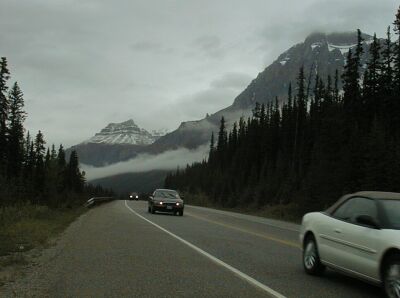
I would ride in peace for as long as five minutes, and then be subject to a big burst of traffic that completely obliterated my peaceful surroundings. The high point of the early part of the ride was a cute little girl waving at me form the back window of a big RV. The low point was a pickup truck that passed into me when I wasn't paying attention and came within a foot or so of me at 60 mph. The traffic was bursty enough that there was plenty of opportunity to pass without endangering me, but a lot of drivers were too impatient to wait that extra ten seconds. Similarly, lots of drivers pulled over partially into the other lane as they passed me, but a lot didn't, and some even seemed to come over towards the shoulder as they passed. This was much ruder behavior than I had experienced in BC.
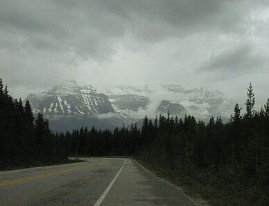
Beautiful Mountain mostly obscured by clouds
Looking back towards Lake Louise
A downhill at about 5900 feet
I stopped at the Mosquito Creek Hostel to see what a rustic hostel was really like. It is really nice with propane heat and light, a wood fired sauna, a beautiful lounge, and a nice dorm that sleeps ten. It also has a 'family house' but I didn't tour that. The woman that runs this hostel had been working at the hostel in Banff for five years before coming out to this remote hostel last year. We discussed the up-scale movement in hostel clientele over the last decade. A lovely, peaceful place, but I couldn't work on my web pages there...
When I reached Bow Lake, one of the most scenic points on the Parkway, I caught up with a couple that had left the Lake Louise Hostel a hour or so before I did. They had expensive new bikes and lots of fancy equipment and clothes, but didn't have the leg muscle development I associate with long term cyclists, so I wasn't surprised to catch them. We visited, but had a hard time talking because of the noise generated by all the traffic roaring by. Then I passed them. I stopped to take a picture of Bow Lake and the Glacier above it and they passed me. Then they stopped to take a picture and I passed them and didn't see them again until about an hour after I arrived at Saskatchewan River Crossing when I saw them riding in.
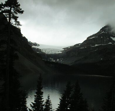
Bow Lake and Glacier, another view
As I rode higher - starting at about 5000 feet and climbing to over 6500 feet - the weather improved. It had been spitting rain for the first hour or two, but it was not raining at all at the top of Bow pass. There was a brief flat section where I adjusted my clothing for the coming down hill, an 8 % grade warning sign, and then a long and dangerous downhill that caught me by surprise.
The summit of Bow Pass
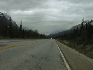
No shoulder and rain ahead
The good shoulder vanished, to return as a bumpy shoulder at the bottom of the hill, the road surface became covered with cracks, swells and pot holes, and the road sustained an 8% downhill grade for more than a mile, then gentled to a 6% or so grade for few more miles. The total vertical on that hill was 1000 feet. I was doing 40 mph - my max was 41 mph - dodging the cracks and potholes and hoping not to get a bad driver trying to pass me when the road was in bad shape. There was a passing lane on the other side and, usually it was clear so that the three of four vehicle that passed me while I was bouncing down that hill were able to do so safely. Looking ahead as I started down that hill, I saw the light rain I was to ride in for the rest the day. My camera got wet in that rain, but I wasn't willing to slow down to put its showercap on, and I didn't think it would stay on at that speed anyway. I lost my map to the combination of bumps and air speed. It came out of my map holder and bounced off my knee. I hated to leave it, but my bike was barely under control and I didn't want to try hard braking.
Rain on the lake where I stopped to don my rain cape
I had dressed for the descent in my wind shirt, which is also my rain shirt and my dress shirt <grin>, and vest and put on my GoreTex overmitts to protect my hands. I rode that was for at least ten miles, but the rain continued and even intensified as I got lower and I finally had to stop by a pretty lake to take off the vest, mitts, and wind shirt and put on my rain cape. The rain cape simplified my life later when I stopped for a break.
One problem with this road: It has no rest stops other than the outhouses at the hostels which are roughly 30 miles apart and nowhere to lean a bike or to sit and rest on this rainy day. This wouldn't have been a big deal if the traffic level were lower, but it makes stopping for a break rather difficult and going to the bathroom even more difficult. I used the outhouse at the Mosquito Creek Hostel. There are services at Bow Lake, and the next services are at Saskatchewan River Crossing which is 25 miles, and a mountain pass, later. That is a bit far to go on a rainy day in the mountains without a break. About five miles before Saskatchewan River Crossing, I found a guard rail - the only one I recall in fifty miles - to lean my bike against and to sit on while I ate and drank. Then I walked a bit away from the road and used my cape as cover while I urinated. The usual method of finding a side road doesn't work when there are hardy any side roads and the few pullouts all tend to be occupied by RVs. None of the pullouts had anywhere to lean a bike, or to sit, or any covered area.
Another problem with this road. The shoulder, in the twenty miles between the two downhills, beat me up. It is one of those cracked and tar striped shoulders that make your bike go thump-thump, thump-thump, etc. It was a pain in the butt and in the hands. It would have been much worse without my suspension stem and much better with a suspension seat post as well. So, there I am, riding along in the rain, bouncing from crack to crack, being passed into and too close to by rude drivers, being deafened by roaring tour buses, and generally just wanting to get off this unpleasant, although pretty, road.
There is another great 1000 foot downhill before Saskatchewan River Crossing. This one has a good shoulder and is not as steep as the downhill after Bow pass. I still found it a bit tense since I was wearing my rain cape and that makes me much more susceptible to wind gusts. I kept an eye on traffic behind me in my mirror and was prepared to drastically slow down if an RV or bus caught up to me on that hill, but none did. The view from that hill was great.

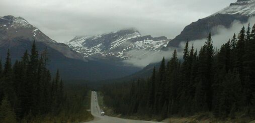
The mountain you see coming down to Saskatchewan River Crossing

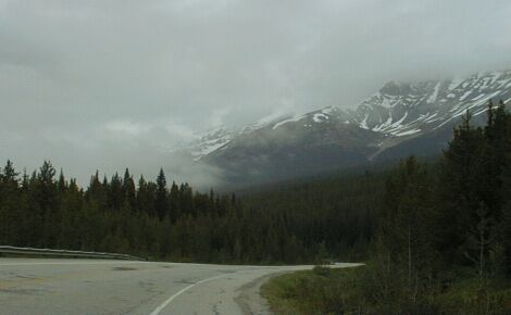
The only choice of route on this Parkway
I got to Saskatchewan River Crossing after 50 miles and 2800 feet of climbing in four and a half hours of fairly stressful riding. I had a, not too good and quite expensive meal at the cafeteria, and then I checked on my routing. I had thought to ride to Nordegg which is east of here on 11, the David Thompson Highway, but when I checked the distance, I found it was 60 miles east. I wasn't up to riding another 60 miles today, so I checked into the motel at the crossing. At almost twice what I have been paying for motels, it is still a better value than the cafeteria <grin>, and, by US standards, not that expensive. The room is fine, the location and view is great, and I hope I can get a good breakfast in the dining room tomorrow before heading east towards Rocky Mountain House.

The view from my motel room - that blue sky is the first I've seen today!