Day 17 Cherryville to Nakusp BC
I rode my first Canadian Pass today, or at least I rode almost all of it. There were a few, signed at, 9% or steeper bits that I choose to walk short parts of.
A short bit that has to be > 10%
It wasn't a bad climb, mostly around 7% interspersed with flatter sections, but the pass itself went on seemingly forever. I had headwinds for almost all the top part and the descent. The top of the pass, ie. The part within 100 feet in altitude of the pass itself, must have taken me an hour to ride! It was a pain, the rest of the ride was pretty nice.
I started riding after 10 AM after a excellent breakfast. It is hard to get away from B+Bs, and this one, Weeping Willow Creek B+B was a special problem because I would have loved to hang out at that lovely place and visit with the owner, Joy Braden, for another day, But this is a bike tour, not a vacation <grin>, so I needed to get on down the road to Nakusp (pronounced n'cusp). That meant riding over The Monashee, down to Lower Arrow Lake, taking the free ferry across to Fauquier, and then riding up the other side of the lake to Nakusp, all on BC 6. A bit over 90 miles with, by my measurement, 4300 feet of climbing. It took me almost eight hours of riding and close to ten hours on the road.
I left the B+B and rode back almost five miles to the Cherryville community center where I turned on, and up, the street that goes up to Hwy 6. This saves a couple of miles and a bit of climbing. The street is pretty steep, but then so is Hwy 6 going up to the pass. I mostly enjoyed the ride up to what I thought was the pass. It was about 2000 feet altitude change and about 2500 feet of climbing because there was a good bit of downhill on the way up that hill! Mainly it was good, if hard, riding because of the ups and downs and ever changing road.
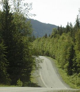
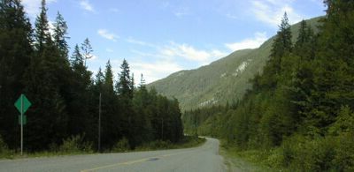
Hwy 6 near Cherryville

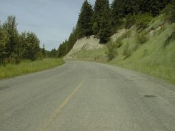
Sign on one of the downs on the way up
One thing that did not change for some 35 miles: the road had no shoulder. This was not a problem since traffic was light.
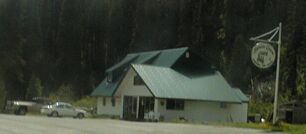
After I got to the pass, with a section with sustained 9% slope and a passing lane, I expected a downhill. Instead I got what looked like a downhill, but was actually level to slightly uphill. This combined with a headwind, made for a depressing ride. I stopped a few miles later at the café, motel, camp ground near the pass still riding at about the same altitude and into a moderated headwind. I passed several campgrounds on the way up, including one, Goldpanners, which has its own café.
I had a decent lunch and a nice visit after lunch with some of the other customers, folks from Kelowna who were heading to Nakusp to 'camp' in their fifth wheel travel trailer. Then I rode on, expecting a downhill.
Instead of a downhill, I got headwinds and 100 foot climbs and descents over and over for the next ten miles. During this period of slow, but hard, riding I finally passed the top of the pass. It was just the highest, by thirty feet as measured on my altimeter, of those hundred foot high hills. They continued for quite ways pass the 'top' and I was not enjoying them or the headwind that kept my speed down to 8 mph or so.
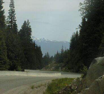
Heading down, at last!
When the downhill did come, it started as neat twisty bit of two lane that was fun to ride, but would have been a lot more fun without the headwind, and then acquired a shoulder and eventually became a four lane highway with good shoulders. This was a long, mostly moderate, downhill that went on for what seemed like more that 20 miles. There was a steep section near the bottom, probably near 10%, but mostly it was a much gentler climb than the west side of the pass. My host last night said she gets regular groups of cyclist from a touring company out of Denver and the man at the general store/gas station/café in Faquier said Bike Across BC is coming through there next month. I think they all come east to west because the slope is gentler and (?) the wind is up that side of the pass.
Hwy 6 eventually flattens out and there is a period of nice riding down a gentle valley to Needles. There isn't much in Needles - a café that was closed and appeared to be for sale - but I stopped for a break before climbing over the ridge to to the Ferry landing on the lake. That is a 500 foot climb, starting at 7 or 8 % and getting gentler afer the first 300 feet of vertical, followed by a mixed descent - they claimed up to 12% grade, but if felt more like 8% - to the ferry.
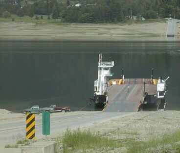
Waiting to load the ferry
I made it to the ferry with five minutes to spare before the ferry's loaded at 4:15 PM.

The view up the lake from the ferry
After crossing, I stopped for a snack. There is a motel, a café', a store and a campground in Fauquier and, at about 50 miles with a mountain pass in the middle from Cherryville, this could be a good stopping or starting place. The Bike Across BC folks will be spending the night there. I chose to ride on to Nakusp.
Hwy 6 north of Fauquier
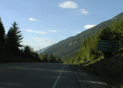
Hwy 6 north of Burton
Because the only traffic going north on this road is from the ferry, riding it meant having the highway to myself 28 out of every 30 minutes. Then a burst of traffic would come by from the ferry. The road was rough and shoulder-less for the first ten miles or more, then became smooth with a good shoulder. It is 57 km, or about 35 miles, from Fauquier to Nakusp. I stopped twice, once in Burton, and once about ten miles from Nakusp, for rest breaks on this, mostly easy riding, section. It was about 8 PM when I got to Nakusp, so I took a, relatively inexpensive, motel room rather than search for a B+B. There is grocery store across the street that I will use to replenish my on the road food supplies - last replenished by Jacqui with an excellent cereal bar and a some fruit 'skins.' Those, along with some not very good bagels and some not very good cereal bars, got me through today's ride. Oh yeah, I mustn't forget the two Canadian O'Henry bars I bought today. They are my favorite candy bar up here and are far superior to 'O'Henry' bars available in the Sates. Just another one of the many good things about touring in Canada.
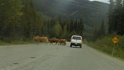
Cattle on Hwy 6 near Monashee Pass
I saw lots of wildlife today, mostly deer, but also lots of birds, including hawks, and several eagle's nests. The low level of traffic on Hwy 6 was illustrated well by the herd of cattle that were standing in the road, blocking it, near the east side of the pass. When I stopped for my last break, 10 miles south of Nakusp, I pulled off on dirt road. It was incredibly peaceful sitting there watching and listening to the birds.