Day 13 Ellensburg to Chelan WA
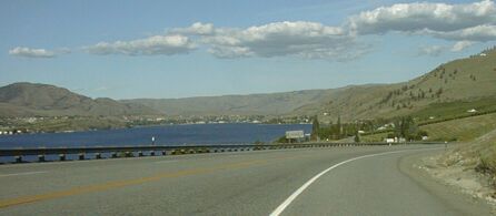
Chelan, coming down from Tunnel Hill on Alt 97
I started the day early, hoping to get gentler winds, suffered ( and cursed) for the first two hours of riding which covered 15 miles, with 1500 feet of climbing, right inot the 15 to 20 mph wind, and then discovered a whole new world 'over the ridge' and one of the best downhills I've ever ridden once I made it over Blewett Pass. A really lousy days riding, requiring intestinal fortitude to just keep pedaling, became a long, hard, but very enjoyable day of touring. Some days you just gotta work though the bad part in order to get to the good. Some other days, the bad part lasts all day <grin>.
It is tilted because of the !@#$% cross wind
My day started early with a quick breakfast in my room, followed by pack ing and checking email, then visiting briefly with the bicyclist next door who was riding from Seattle to Kentucky. Then I rode to a nearby restaurant for breakfast. Since I had been told there were no service on US 97 for more than 50 miles, I wanted a good breakfast. I got it, but very slowly and more breakfast than I ordered. I was tired of waiting, so I accepted my $10 breakfast, which should have been a $6 breakfast, and ate as much of it as I could. Then, roughly 20 minutes later than I had expected, I headed out into the wind. Riding out of town, I was able to do 9 to 10 mph on the flat. Riding on US 97, I was reduced to 6 to 8 mph depending on the slope - pretty constant, - and the wind. It wasn't as bad as yesterday, but I still rode along fantasying about hitching a ride over the pass and worrying about running out of water, since the air was dry and the riding was hard.

The First Ridge
After 13 miles or so of grinding slowly uphill into the wind, I was rewarded with the sight of the road climbing more steeply. The actual climb was maybe 500 feet - I had already climbed about a thousand feet - and it was better riding than the flatter section because the wind decreased as I climbed. Near the top, looking southwest, I cpould just see the top of Mt Ranier peaking the nearer hills. Once over the top, at 15 miles into my ride, riding became much nicer. I descended about 400 feet vertically in the next three miles, riding down into a pretty valley. A few miles later, I came upon a Cafe(!)

US 97 in the valley
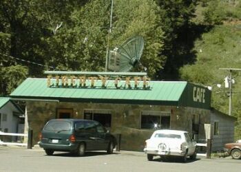
Liberty Café
There were services! I stopped, discovered that the lady running the place was a bit of a bicyclist, and had second breakfast since I didn't know where the next services would be. I was rather stuffed with my two breakfasts; so stuffed that I wasn't hungry again till 4 PM.
Less than a mile after Liberty Café, maybe 20 miles from Ellensburg, US 97 enters the national forest. There is a restaurant not far into the forest, but it wasn't nearly as popular as Liberty Café. The next places to eat are just outside the forest on the other side of Blewett Pass. Those places are about 43 miles from Ellensburg.
Climbing Blewett Pass was easier than climbing White Pass. The total climb from Ellensburg was about 3500 feet: 1500 to get over the first ridge and then 1500 from that valley at 2600 feet to the pass at 4100 feet. Actually, I think I measured 3800 feet of climbing which is very close to what I measure on White Pass. The climbing was pretty gentle except for getting over that first ridge and the final 1000 feet vertical at the top of the pass. The shoulder was wide everywhere except that last sustained climb, and there it was still wide enough for my loaded bike. There were some sections near the top that made me nervous because of the relatively narrow shoulder and a guard rail that didn't give me any way to get out of the way of a bad driver. It was also very noisy since there was a moderate amount of traffic, including big trucks and RVs . I used an ear plug in my left ear for the section near the top of the pass to make riding less unpleasant. I also stopped twice to rest and recover on the way up. My legs were tired from yesterday's and today's riding into the wind. That 20 mile section between Yakima Canyon and the first ridge, is likely to always be headwind city in the summer. Yesterday wind was exceptionally bad, but today's 15 to 20 mph winds from the NNW, are typical.
Once at the top, I put on my Sugino vest - I'm sure using it a lot - and headed down the other side. It is basically downhill from the top to US 2! That is over 20 miles with a drop of about 2500 feet. It has decent shoulder almost all the way, and I had no trouble with the traffic. These Washington passes have some great downhills. I stopped for a snack and a rest break about seven miles from US 2. That store is located on a short flat section in the middle of the long downhill. Then I rode on down to US 2. My riding time for the 30 miles or so from Ellensburg to the top was a bit over three and a half hours and my riding time for the 23 miles from the top to US 2 was about an hour. It was 8:15 when I left Ellensburg and 2:30 when I reached US 2.
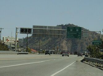
US 2 just east of where US 97 joins it. 49 miles to Chelan
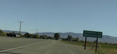
While US 2 and US 97 are together, riding them is pretty much like riding a, not too busy, interstate. US 2 follows the Wenatchee River down to Wenatchee, so, except for a hill or two, riding is easy for that 15 miles. I was quite tired and I stopped at the county park near Cashmere to rest and recuperate about 3:30 PM. I was planning to eat a snack from my supplies and lie down in the shade for half an hour or so. Instead, I was invited join a couple from Seattle in a late picnic lunch. We had great visit, I got well fed - she is a chef and he works for Marriot - and the conversation was excellent.
US 2 / US97 and the Wenatchee River
Shortly after I got on back the road, I stopped to put my earplug back in. There was lots of traffic in the section from Cashmere to Wenatchee, and it was noisy on that shoulder!
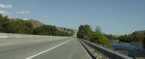
At Wenatchee, I headed north on Alt US 97. That runs on the west side of the river, while US 97 and US 2 run on the east side. Trucks aren't permitted on Alt 97 and it has an excellent shoulder. Riding was superb - I was averaging over 15 mph thanks to a good road and a good tail wind.

Heading north on Alt 97
I reached Entiat in less than an hour and stopped at their city park for a break. That park has showers and lovely tent, as well as RV, camping sites right on the river. A really nice park, but I wanted to get to Chelan and pay a lot of money to stay at a motel <grin>, so I rode on.
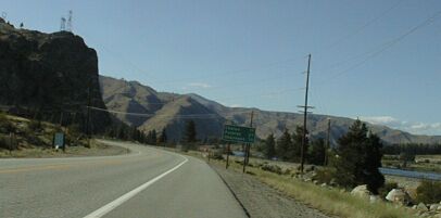
Alt 97 just north of Entiat
Riding was great for next ten miles, then I encountered Tunnel Hill. While US 97/US 2 continue along the other side of the river, Alt 97 climbs over the ridge to reach Chelan Lake. That meant another seven hundred feet of climbing for my tired legs! The steep climb to the tunnel is followed by a more gradual climb over the top of the ridge for then next four miles, then there is the great downhill to the lake. I could have done without riding over Tunnel Hill at the end of a 100 mile day with 15 miles of riding into bad head winds and a mountain pass. Still, Alt 97 seems the best way to get to Chelan.
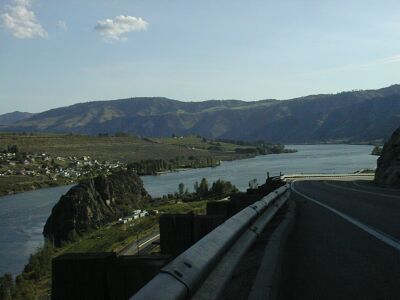
Looking back, 400 feet up, from near the entrance to the tunnel
The tunnel is well lighted, but it does not have shoulders. It does have those "ped/bike in tunnel" warning light s and I used them. Luckily, not other traffic was in the tunnel with me. After, groan, riding over Tunnel Hill, it was an easy rid into Chenlan where, on this weekend night, I am spending too much money at the cheapest motel in town . It is nice place and I, after my hard days ride, need to get to bed....