
Day 10 Longview to Packwood Washington
Rifle Lake, in the rain and clouds
Despite my best intentions <grin>, I had another one of those wet riding days Oregon and Washington are famous for. I rode about 100 miles, with maybe 40 of it in the rain and all of it the 50 - 58 F temperature range. I experience a few short 'Sun Breaks' early in the ride and a long ride in the rain at the end of the day. Despite the low clouds, 'liquid sunshine' and the lack of any long range views while riding through really beautiful country, it was good ride. I was feeling rested from my day off, and that helped. I rode WA 411, 506, 505, and Jackson Hwy, all of which are very nice riding and that helped. I had several good stops on US 12, which is not bad riding and the visits with people when I stopped made it good riding. Finally, I had a double semi coming up a long hill on US give me a toot-toot of encouragement on his air horn. That helped too. And, at the end of the day, I'm warm and dry in a nice motel room in Packwood. Ahhhh.

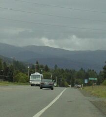
411 with and without shoulders and blue sky patches
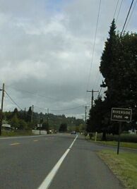
I was a little worried about getting from my motel to WA 411 heading north. It was only a few blocks, but they were bolck of four lane roads with heavy traffic. I walked it yesterday and planned it so I only had to cross one road and do one right turn. That worked well this morning. Once on 411, the riding was good and the traffic light. About five miles out of Longview, the shoulder on 411 goes away, replaced by some nasty steep gravel slope that would be very dangerous to crash on. Fortunately, the traffic was light and very polite so I had no problem.
After ten miles, Delameter Rd comes into 411 on the left. This is the ACA route that takes Coal Creek Rd off of WA 4 before it reaches Longview. I rode that route in '96. Going through Longview on 4 and then going north on 411 is, I think, faster and easier than the ACA route. The ACA route would be better for a group, since riding, as a group, through Longview would be dangerous, but the other is fine for a solo rider, like me, who is willing to trade a little traffic for an easier ride with more services.
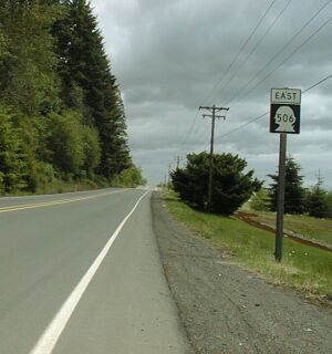
I stopped for a meal at the 4 Corners Café at the intersection which the ACA route takes into Castle Rock. Then I rode 411 north till it ended at 506, 506 east and north till it ended at Toledo. At that point I rejoined the ACA route heading north. Having done both routes, I think the 411 (from Delameter Rd north) to 506 route is superior to the ACA route. It is more direct, less confusing (I get confused easily!) and excellent riding. 506, in particular is great fun as it swoops down from the point where 411 ends until it reaches I-5. There are services at that point and again, a mile or so later, where it crosses I-5.
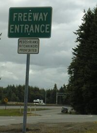
A very non-ideal, but legal, bike route!
I wasn't hungry when I reached Toledo, which has several places to eat, so I headed north on the ACA route (505 then Jackson Highway) to WA 12.. On the way I diverted through Lewis and Clark State Park. It is one of the most beautiful places I have been. It was also very damp today. I had thought of camping there again, but neither my timing or the weather worked out. I do love the old growth forest there, but it definitely rain forest.
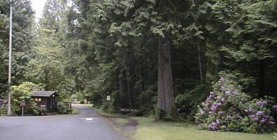
The entrance to Lewis and Clark
I stopped at Mary's Corner, the intersection of 411 and 12, for the best food buy of the day: a large chicken breast and a 16 oz cup of coffee for $2.50. As she handed me the chicken, the convenience store person said 'Careful, it is very hot. I just finished cooking it." It was good, and I at it with a bagel and some apple sauce from my supplies.
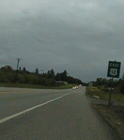
Heading east on WA 12
For the first ten miles on WA 12, I felt like I was riding across the plains. It was pretty flat, nearly straight and a bit boring. I was relieved when, about Salkum, it got hilly and curvy. There is a lot to be said for variety in bike touring. I love the plains, but riding a bike over flat straight roads is harder for me mentally than riding hills. My most boring and hardest bicycling experiences have been on rail trails in Wisconsin and a unopened freeway in the mountains of Tennessee. In both cases, I had a really hard time just forcing myself to keep going. WA 12 was like that, but not for long enough to be a problem.
Once it got into the foothills, it was, except for too much traffic, good riding.
The only problem, other than the rain that began to fall before Mossyrock, was that the shoulders on WA 12, which were great, disappeared on the long bridge over Mayfield Lake.
That was scary since there was a moderate amount of high speed traffic in both directions and no way to get out of the lane. Fortunately, my timing was pretty good and the only vehicle that might have endangered me, slowed down, stayed well back, and waited till I had gotten off the bridge before trying to pass me. Very polite behavior was typical of Washington drivers, but I'd hate to get on that bridge with a jerk behind me.
I stopped to eat a snack in Mayfield and an early supper in Morton. Morton is the big town on this stretch and the classy Mexican restaurant there was really a nice place to eat. The manager, who was Mexican, as was all the staff I saw, was friendly and impressed that I was bike touring. I high recommend it as a lunch or dinner stop.
By the time I got to Morton, it was raining, not just showering, and the temperature was in the low 50s. I considered quitting for the day since there was a nice motel right by the Mexican restaurant. I decided to ride on to Randal, the next town with services and see what developed. What developed was waves of rain separated by showers, but I was doing OK wearing my thermax long sleeved shirt under my supplex nylon all purpose short under my Sugio vest. I stopped for dessert in Randall, mainly to use the bathroom and get out of the rain and cold. The place I stopped is called the Huff and Puff - seems appropriate for a bicyclist! - and the only deserts that had were ice cream based. I was looking for warm, so I settled for a cup of coffee and a Large pineapple mikshake. Were talking a quart of excellent mikshake. While I was enjoying the coffee and milkshake, some local were talking about the school systems and the economy of the area. It was good discussion and I learned a lot. Then I got invited into the discussion and we talked about bicycle touring for half an hour. Nice folks. After that, I had to ride on to Packwood as a matter of honor. The rain had increased and the temperature dropped so I finally took off my vest and put on my rain cape. The remaining 15 or so miles to Packwood was a remarkably flat, but not straight <grin>, ride through a beautiful mountain valley. I'll have to come back somday when I can see beyond the hills to the mountains behind them.
I was actually more comfortable on this section than it had been earlier, because the combination of the vest and the two shirts worked well for the, relatively constant, conditions I was riding in. Never the less, I was very happy to see this motel in Packwood. I got here about 8 PM, having left Longview about 9 AM. My actual riding time was eight hours and thirty minutes, so that leaves two and a half hours for eating and visiting along the way. That is just about perfect. Oh yeah, I had to spend about 30 minutes cleaning my bike, drying it off, and putting my Arkel panniers, both of which have dry bags in them for this part of the trip, out to dry. I just dried off the Ortliebs on my bike.
I wish!
I have been told that I rode through some very spectacular scenery today. I believe it, but with rain and clouds limiting my view, I didn't get to see much of it. Tomorrow should be a better weather day. Maybe I'll even get to see Mt Ranier. The view is supposed to be quite nice from Packwood!