 On a sunny, but cool, spring day I headed out on one of my
longer rides. This is a loop that goes south from my home in Asheville to
the Blue Ridge Parkway, then south on the Parkway for thirty five hilly
miles, and then back to Asheville via the beautiful Rt 215. The total ride
distance is about 95 miles and the total climbing is about 8000 feet, mostly
between mile 20 and mile 45. My route goes south through downtown Asheville
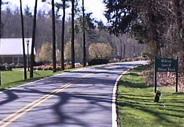
to Biltmore Forest. This is Vanderbilt drive entering Biltmore forest from
the north. It is about half a dozen miles from my house to this point and
then it is four miles to the Blue Ridge Parkway following Vanderbilt Dr and
then Stuyvesant Dr through this exclusive residential area. The sun is
shining and the temperature is about 60 F as I ride through the manicured
streets of Biltmore Village. I know that the temperatures will be at least 10
dgrees colder at 5000 feet, so I'm dressed for 50 F riding. The problem with
riding the Parkway is finding a combination of clothing that will let you
ride up a ten mile long hill without overheating and yet keep you warm when
you are at higher altitudes and, especially, when you are coming back down
those long hills.
On a sunny, but cool, spring day I headed out on one of my
longer rides. This is a loop that goes south from my home in Asheville to
the Blue Ridge Parkway, then south on the Parkway for thirty five hilly
miles, and then back to Asheville via the beautiful Rt 215. The total ride
distance is about 95 miles and the total climbing is about 8000 feet, mostly
between mile 20 and mile 45. My route goes south through downtown Asheville
to Biltmore Forest. This is Vanderbilt drive entering Biltmore forest from
the north. It is about half a dozen miles from my house to this point and
then it is four miles to the Blue Ridge Parkway following Vanderbilt Dr and
then Stuyvesant Dr through this exclusive residential area. The sun is
shining and the temperature is about 60 F as I ride through the manicured
streets of Biltmore Village. I know that the temperatures will be at least 10
dgrees colder at 5000 feet, so I'm dressed for 50 F riding. The problem with
riding the Parkway is finding a combination of clothing that will let you
ride up a ten mile long hill without overheating and yet keep you warm when
you are at higher altitudes and, especially, when you are coming back down
those long hills.
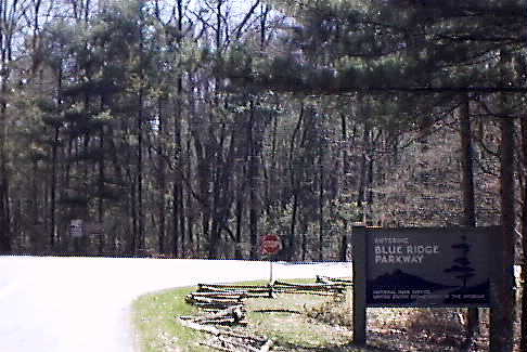
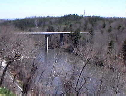
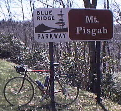
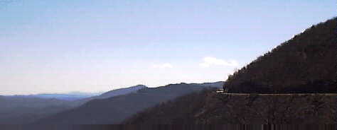
After leaving Biltmore Forest at the US 25 entrance to the Parkway, I head south towards Mt Pisgah. From this point on the Parkway, it is 19 miles to Mt Pisgah and and eighty miles to the southern end of the Parkway. The first five mile are gently rolling with only a few hundred feet of climbing. Then the Parkway crosses the French Broad River at about 2000 feet and heads up the hill to Mt. Pisgah at about 5000 feet. That is US 191 in the bottom left of the picture.
It is a long climb up to Mt Pisgah, with about 3500 feet of climbing in 14 miles. There are a few flat stretches, but mostly it is just a long hill that takes me almost two hours to climb.
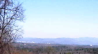
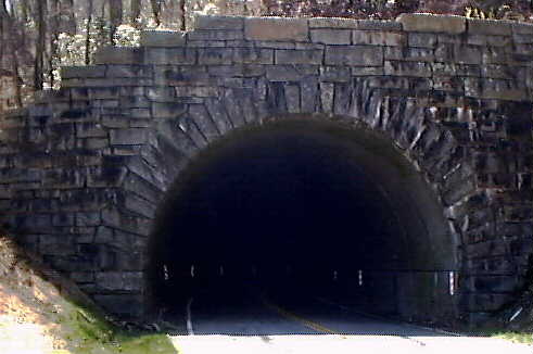
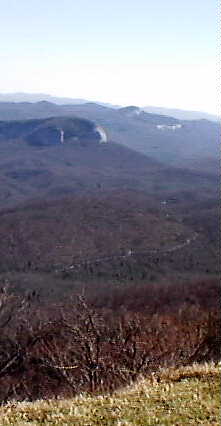
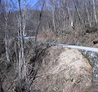
Early on there is a great view (not very well represented by this digital photo from a cheap camera) looking back towards Asheville. The lighter colored area in the left middle is Asheville. The light block on the right side is the Biltmore House. This is, as far as I am aware, the only place on the Parkway where you can actually see Asheville. About four miles after you start up the hill, you reach the first of nine tunnels. This is the entrance to Grassy Knob Tunnel. It is about 800 feet long, so you need lights to safely ride through it. The next tunnel, Pine Mountain Tunnel, is, at over 1400 feet long, the longest tunnel on the Parkway. If traffic is heavy, and especially when there is a lot of RV traffic, these tunnels can be a bit frightening to ride through, but the upper nine tunnels are all 500 feet long or less, and as such there is little problem riding through them even without lights.
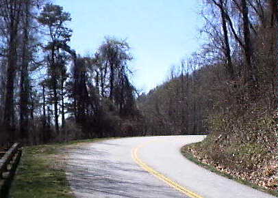
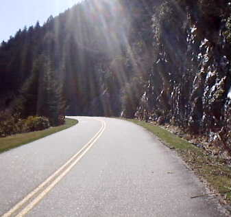
After you reach the top the near BRP milepost 408, it is an easy ride to the Pisgah Inn. I like my rides to be punctuated by places to eat. After 30 miles and over 4000 feet of climbing, I'm ready for a late lunch. The Pisgah Inn is quite a nice place, nice enough that I feel a little out of place in my sweaty cycling clothes, but they are always gracious and, except when they are extremely busy, both the food and the service is good. Here is the view looking south from the Inn's dining room. Not bad! That is the Parkway heading along the top of Pisgah Ridge.
After lunch you resume riding on a pretty level stretch of Parkway, but it isn't long before you're headed downhill. Heading downhill means heading uphill again a bit later and this pattern is repeated with two 500 foot hills before you start up a big hill that passes the Shining Rock Wilderness area. This hill goes from about 4500 feet to 5700 feet. This is a pretty section of the Parkway with great views of a high mountain valley and the headwaters of the south branch of the Pigeon River and a good bit of climbing.
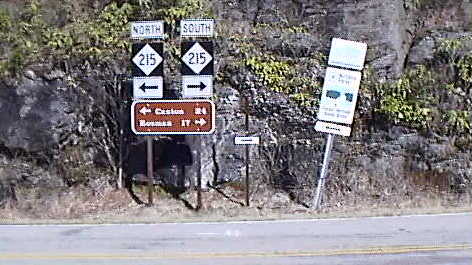
Shortly after Devils Courthouse at mile post 422, Rt 215 crosses under the Parkway. Heading south on Rt215 would take you to Rosman, NC and, continuing on south, to Pickens SC. Heading north takes you to Canton NC in 24 miles and, continuing north on other roads, you can get back to Asheville in another 25 miles. We've come 45 miles and have 50 miles to go, but we've climbed about 6000 feet and only have another 2000 feet of climbing to do, so it isn't as bad as it sounds! It was after 4 PM and the temperature was about 50 F as I started down. Almost all of the road was in shadow, and the wind chill, at 30 mph, was in the 30 F range. Brrr.
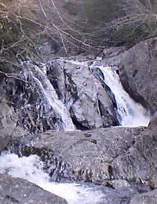
215 is a great bicycling road and the first ten miles heading north from the Parkway is all downhill. It is a twisty road that follows the north branch of the Pigeon Forge River down into Canton. The Parkway traveled alongside the south branch of the Pigeon Forge as it climbed into the Shining rocks area. There are waterfalls on this road and, in the fall, some of the best displays of leaf color I've ever seen.
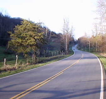
After the ten mile downhill, 215, and the Pigeon Forge, level out and the ride for the last ten miles into Canton is only a gentle downhill. It usually takes me an hour to an hour and a half to ride the twenty four miles from the Parkway to Canton. If you follow 215 into Canton, turn right after it crosses the river and follow that road around the paper mill that dominates Canton. When that road ends at a stop light at the top of a hill, turn left on Newfound Rd.
At Canton I'm ready for another meal, this time at a very down home hamburger joint. It is 6:45 PM ( I started this ride at 11:30 AM) as I head out of Canton on Newfound Rd. Five miles later I'm climbing Newfound Gap and then cruising
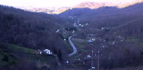
down the other side into Newfound valley. The long shadows from the hills I crossing mean that most of the valley is in shadow. I've got an hour of light left and about twenty miles of riding to go. It will be almost dark before I get home, but I know I have my lights if I need them. Today I don't, barely.
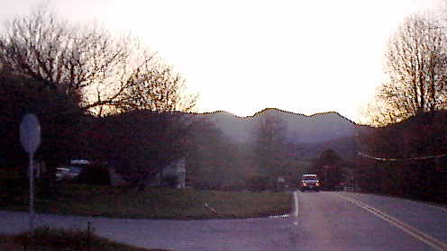
Sunset over Newfound Gap
When Newfound Rd nears Asheville it turns east and joins a rather busy highway. I turn (by the Newfound Community Sign) on Brookshire Rd which, a mile or so later, crosses that same highway and becomes Ramsey Rd. Ramsey Rd ends, a mile or two later, at Old Liecester Highway, where I turn right towards Asheville. After Old Liecester Highway crosses the French Broad river, if you want to ride into Asheville, turn right and ride down the river. Continue under the expressway on Broadway (four lanes, light traffic) into downtown Asheville. I turn up the river and then use back roads to get back to my home. It is 8:30 when I arrive. I've been gone for nine hours, riding for seven hours at an average speed of 13.3 mph. I'm tired and sore, but happy!