Don Patterson's Mt Mitchell Photos
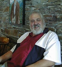
Don Patterson
I've been riding up Mt Mitchell for four years now, and for three of those years Don ran the restaurant on top the mountain. Now eating and bicycling are intimately related for me. I plan my rides around the places where I like to eat and Don's 'place' was a part of every ride I made up here during the season when the restaurant is open. That season is May through through October, and I like to ride up every week, so I made a lot of visits to Don's Place. Don and I became friends and, now that he has retired from running the restaurant, we still try to meet up here for lunch weekly when we are both in the area. Most of the pictures on this page were taken by Don as I rode by on my way up and down the mountain.
I've already documented riding up to Mt Mitchell from Asheville in my 'Fall ride up Mt Mitchell' page, so I though I'd try to use Don's photo's to do a better job of documenting the ride after you leave the Blue Ridge Parkway. It is 30 miles with about 4,200 feet of climbing from my house to the start of the road up Mt Mitchell. It is only about 3 miles up that road to the restaurant, with another 1200 feet of climbing. From the restaurant to the actual top of Mt Mitchell is another two miles with about 300 feet of climbing, mostly in the last half mile. Here is a picture of Mt Mitchell taken from the Parkway about ten miles south of the road up Mt Mitchell.
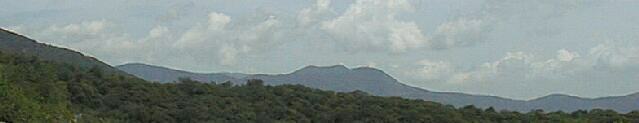
The humps in the middle are Mt Gibbs, Clingman's Peak and Potato Knob, and the hump on the left is Mt Mitchell. Clingman's Peak and Mt Gibbs look higher than Mt Mitchell because Mt Mitchell is a little farther away. The parkway is just visible in this shot as a faint sloping line running near the base of Potato Knob, the peak in front of Clingmans's Peak. All of these peaks are over 6300 feet and Mt Mitchell is almost 6700. The almost flat section between Clingman's Peak and Mt Mitchell is a ridge with great views both north and south. The road runs along the south side of that ridge, just below the top and the restaurant is located on the top of the ridge.
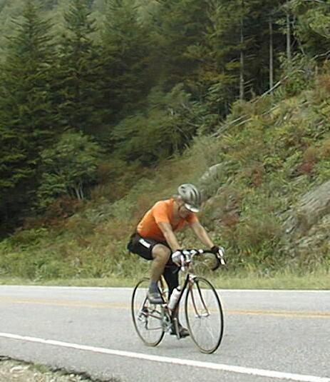
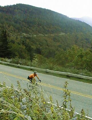
Most of the 1200 feet of climbing between the Parkway and the restaurant comes in a two mile section just before the entrance to the park. Here I am riding up that section. I thought I was just cranking along, as much as one can crank along on an 8% grade, but this shot makes it look like I was working hard! After you start up the road to the park, the grade picks up pretty rapidly into the 8 to 10% range and stays there till just before you reach the park entrance. Then the grade is only a few percent for several miles. After the climb to the park, it feels almost flat as it runs along the ridge between Clingman's Peak and Mt Mitchell. Here are some shots Don took as I rode into and in the park.
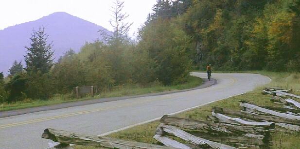
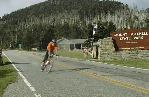
Nearing the gate, the hill is starting to level out - probably a 5% grade here!

After the gate it is almost flat - I'm cruising along over ten mph
This shot, taken near the restaurant, shows the road along the ridge in the background and persimmons in the foreground. Don took this shoot from the parking lot of the restaurant.
Here I'm on my way down the mountain after lunch with Don, as you can see by the shadows it was a late, and long, lunch
In the upper middle area of this shot you can see the dead fir trees that are found everywhere above about 5500 ft in this area. Don used to tell customers who asked what happened to tree - and lots of customers asked - that a huge flock of woodpeckers had stopped on the mountain top and killed the trees. Reality is a little more complex: acid rain caused by power plants weaken the trees and infestations of a beatle, killed them in their weakened state. As the pollution gets worse, and it is continuing to worsen, the kill altitude is going down. The fir trees on Mt Mitchell, which is the highest point in the USA east of the Rockies, died first
Once past this point, I'm going faster than Don can in his Blazer so he wasn't able to get any more photos. I am doing about 25 to 30 mph at the gate and I get above 40 mph before the first real turn below the gate. I stay above 40 mph the rest of the way down. It is a bit twisty in spots with corners marked as low as 20 mph, so it is an exciting ride at 40 to 50 mph.
I once had a stupid (truth...) driver in a full size Buick sedan try to tailgate me going down. Darn slow bicycle had no right getting in his way! I took one of the upper corners at 45 mph and he didn't. I looked back to see his car discombobulated and sliding sideways across the road. It wasn't pretty. Fortunately he didn't go off the road. Also fortunately, he drove much more slowly the rest of the way down. Darn slow bicycle indeed!