Asheville to the Parkway Via Curtis Creek Road
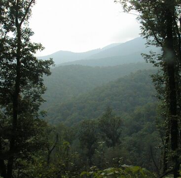
Looking out from near the top of Curtis Creek Rd
The notch in the ridge in the center of the picture is the Blue Ridge Parkway near Green Knob. Curtis Creek Road runs from just east of Old Fort NC up the to Parkway two miles north of Green Knob. Since getting to Curtis Creek Road requires riding from Asheville down to east of Old Fort, about 40 miles, and since Curtis Creek Road is a steep dirt and gravel road more suited to a mountain bike than a road bike, this is not the easiest way to get to the Parkway! However, if you are a strong rider who wants a serious loop ride starting in Asheville and combining dirt and paved roads, this could be a good ride. That loop would be close to 90 miles with roughly fifteen miles of dirt roads and nearly one and a half miles of vertical.
I rode from Asheville to the Parkway via Curtis Creek and then crossed the Parkway to ride down Niels Crek Road to Toe River Road and then to my friend Don Patterson's house. It was good that I had not planned to ride back to Asheville on the Parkway since my legs were cramping so badly by the time I got near the top of Curtis Creek Road that I couldn't pedal my bicycle. I walked the last mile or so and then, still fighting cramps, was able to coast (not the right word for descending a steep (> 10% grade) dirt with loose gravel road!) down Niels Creek Road. Curtis Creek is a hard climb!
Old Farm School Road
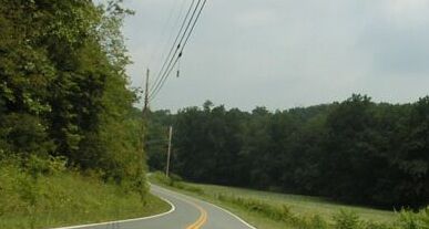
Old US 70 near Black Mountain
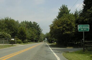
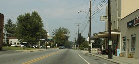
US 70 going into Black Mountain
The ride from Asheville to Black Mountain via Warren Wilson College is nice. I've documented it in another web page, Atride around the Black Mountains, so I won't dwell on it here. Black Mountain is also nice: lots of little shops and places to eat. It is about 20 miles from Asheville to Black Mountain, and 15 more miles to Old Fort.

Heading down Mill Creek Rd
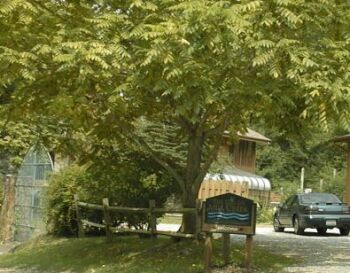
The Mill Creek Bed and Breakfast

Heading towards Old Fort on the paved part of Mill Creek Rd
Since you can't ride on I-40, getting down the hill to Old Fort requires riding Mill Creek Road. Mill Creek Road starts a few miles east of Black Mountain as a good dirt road which is rideable on a road bike, but more comfortable on a bike with fatter tires. You follow US 70 along side I-40, then continue on past Ridgecrest on old US 70 which turns away from I-40 right after Ridgecrest and deteriorates dramatically. A mile or so later, Mill Creek road heads off to the left just before old US 70 is blocked by a barrier. A few miles later you pass the Mill Creek Bed and Breakfast just before the steepest and roughest section of Mill Creek Road. You might want to walk your road bike under the railroad trestle and down the steepest bit, but that short stretch is the only part of the road that is a problem for a road bike.
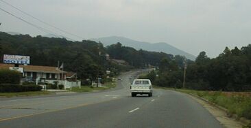
Riding through Old Fort
At the bottom of the dirt section, turn right on to a paved road, then, shortly, turn left onto old US 70 and follow it into Old Fort. This section is very nice riding. Old Fort, while not as cute as Black Mountain, also has places to eat and shop. Turn south towards I-40 at the light and you'll find several fast food places a few blocks later. Then you'll need to ride back to the light to continue east on US 70 since Mill Creek, which you have been following since the Mill Creek B+B, runs through the town and there is only one bridge.
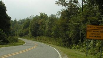
They aren't kidding about the Steep Winding Road!
Just east of Old Fort, right after the big furniture plants, Curtis Creek Road heads north towards the Parkway. It is paved for the first few miles and gentle, then it becomes dirt and increasingly steeper for the next ten miles.
Curtis Creek mile or so up the road.
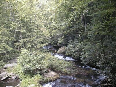
As the road climbs, it follows Curtis Creek into a national forest and though several miles of the Curtis Creek camping area. This is a very popular camping and day use recreational area and, as I rode through it on a Saturday in late August, almost all of the sites were in use. The camping area is bisected by a gate where the road is closed in the winter. As you might expect, it gets steeper above the gate <grin>. I'd estimate the sustained grade at 12 to 14% in the steepest parts. It was so steep that I had trouble getting restarted after a rest break because I couldn't get enough traction. I had to walk up the road to find a spot were there was no gravel or sand on the hard packed dirt in order to get started again.
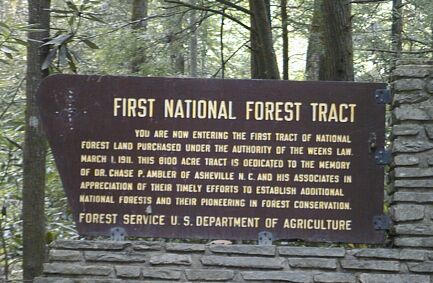
Entering the National Forest

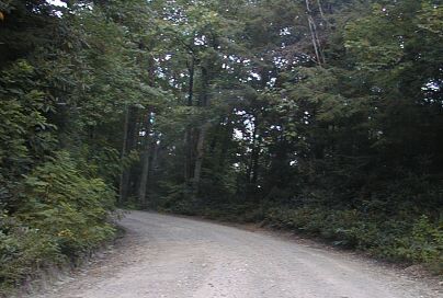
Curtis Creek Road

Getting Steeper
With lots of switchbacks in the last few miles
Riding my touring bike with a 20/30 low gear and 700x32 tires, I was able to manage 3.5 mph at 60 RPM or so with my 40 pound bike plus luggage weight. I had some trouble maintaining traction, but the main problem was simply that I was on the edge of my ability to get up that hill that day. I emptied two water bottles in ten miles and had to walk up the top mile or two of the hill. It is a hard climb, although the top is actually much gentler than the section just before the switchbacks and the switchback section, however my legs were too far gone even to pedal up a gentle grade. I'm thankful I had a downhill route from the Parkway to my destination, otherwise I might have had to hitchhike home once I reached the Parkway!
The cramps I experienced were in muscles on the inside of my thighs. Those are not muscles that I have had cramping problems with before, so I think the problem was caused, or at least exacerbated, by the way I rode up the steep section of Curtis Creek. Because I was near both the limit of traction and my aerobic limits, I had to pedal unusally slowly and very smoothly. I think I was using my leg muscles differently and that I was using muscles I don't normally use.