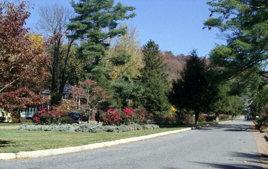
The Rose Garden on Griffing
The city of Asheville isn't a great place to ride a bike - too much traffic and too little provision for bike riders - but the areas north, west and east of Asheville offer some the best bicycling in the USA. Although there are some good rides south of Asheville, I think the best riding is on the Blue Ridge Parkway and in the area north and west of the Parkway. Arguably, the Blue Ridge Parkway itself is the best riding of all, but I ride a lot of routes that I thinks are at as good and, in a few case, better. than most of the Parkway. This page is a introduction to those routes for riders who have not explored that area.
The Rose Garden on Griffing
There are few flat places to ride, but, in each part of Asheville, east, west, north, and south, of Asheville there are some decent short rides that are relatively easy and, just as important, relatively traffic free. These rides require little in the way of preparation.
In south Asheville, you can ride through Biltmore Forest. Use Vanderbilt Dr, near the All Souls church to enter Biltmore forest from the north. It is about four miles to the Blue Ridge Parkway following Vanderbilt Dr and then Stuyvesant Dr through the manicured streets of Biltmore Village. This route has very little traffic and gentle hills. At the south end, Stuyvesant Dr connects with the access road from US 25 to the Blue Ridge Parkway. This is also the best route to get to the Parkway going south from Asheville toward Mt Pisgah.
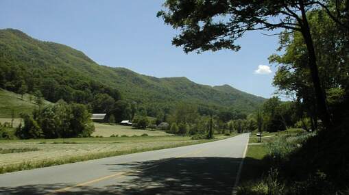
The Blue Ridge Parkway south of Asheville
In east Asheville, Azalea Rd, which starts by Asheville's Rec Park on Swannonoa Rd and run to US 70 near Lower Grassy Branch Rd, is a great gentle ride and, like the ride through Biltmore Forest, a useful way of starting longer rides. Lower Grassy Branch connects to Old Farm School Rd which is the nice way to ride Warren Wilson College. From Warren Wilson you can ride Bee Tree Rd and then Old US 70, into Black Mountain. From Black Mountain you can ride south on NC 9 or east on old 70 and Mill Creek - a good dirt road - to 70 down by Old Fort.
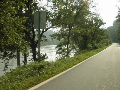
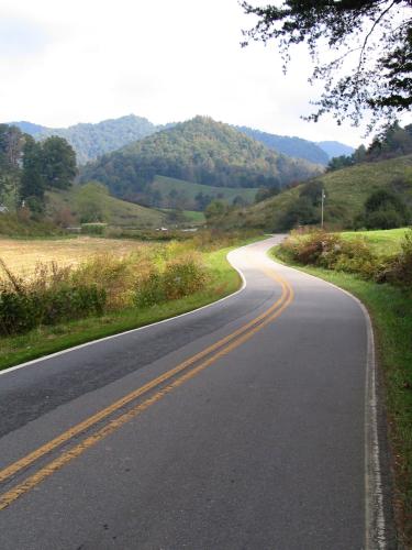
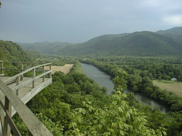
The French Broad River from NC 251
In west and north Asheville it is hard to find flat rides. Riding north along the river, starting from one of the parks on the river is the easiest riding, but I won't ride there during the day because of the truck traffic. Riding along the river in the other direction, going south from Broadway is easy riding but not that pretty. However, this is a very useful route for riding between north and south Asheville and, if you cross the river on the Craven St bridge and ride up Waynesville Rd, a good way for riding to west Asheville.
North Griffing which becomes Sunset Dr
In the west part of town, riding on Sulphur Springs Rd starting from Haywood St and heading west into the Malvern Hills area is very nice, but moderately hilly. In the north, riding on Sunset Dr starting from Old Toll Rd is gentle and quite pretty, but the other end, where Sunset has become North Griffing Blvd, gets quite steep. If you are in good enough shape to ride up the bottom part of Old Toll Rd, there is a very nice loop made by Old Toll, Sunset, North Griffing, Country Club, and Grovewood Rd. You cut through the Grove Park Inn parking lot to get to Macon which, very shortly, becomes Old Toll. This is a spectacular ride, and there is some challenging climbing involved.
Once you start to ride out of Asheville in any direction except along the river, you need to be ready for some serious climbing and, even along the river, you need to be comfortable riding in traffic. You should also carry water - climbing is thirsty work - and be prepared for some common bike problems like flat tires. Lots of folks ride into the mountains with inadequate supplies and no knowledge of how to repair a flat tire. It isn't a big deal to carry water bottle(s), a pump, tire tools, and a patch kit. If you don't know how to do simple things, like fixing a flat tire, ask your bike store if they offer classes in basic bike maintenance and repair. Once your rides get longer than 20 or 30 miles, you should plan on carrying food or stopping to buy it. Note that there are very few places to buy food on the Parkway and the nicest rides in the mountains are on back roads with few services. Carrying the food and water you need is the only sure way to avoid dehydration or boinking!
My route descriptions here assume that you have a decent maps and look up the roads before you try to ride them. http://maps.google.com/ is also good for checking out these routes. Many of them are discussed, with images and more detail in my web pages, but I'm not providing cue sheets. It is up to you to understand the routes and to prepare yourself and your bike for riding them. Riding safely in the mountains requires both bike and rider to be in good condition. A tire blowout or a brake failure is far more dangerous in the mountains than when riding on flat land! A broken down bike in town may require a phone call for help. A broken down bike in the mountains can require a very long walk to get help. Been there, done that: I pushed my bike for 14 miles in the dark because I only had one patch for two holes and my spare tube was bad. Don't count on your cell phone. It probably won't be able to connect.
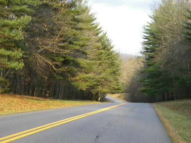
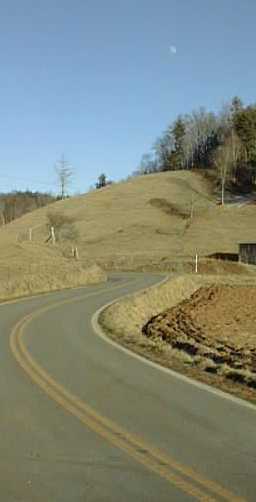
Newfound Rd
When I ride out Lakeshore on my bike, I go down to the river in Woodfin, and then, instead of going north towards Marshall, I ride south along the river to the first bridge. I turn right across the river and ride the Old Leichester Highway to the east. This is not flat riding, but, by Asheville standards, it is an easy way to get out of town.
There are several rides I enjoy that start this way. The easiest one is to ride out through the Newfound valley and back. To get to Newfound Rd from Old Leichester, turn left, roughly half a mile past Juno, on Ramsey Rd. About two miles later you cross 63 - the new Leichester Highway which has high speed traffic so be careful! -- and ride on Brookshire Rd for less than a mile to reach Newfound Rd. Turn right on Newfound Rd. It starts out pretty hilly but, a few miles later, it settles down into a nice gentle ride up the beautiful Newfound Valley.
You can do this ride as an out and back or, with more climbing. continue on over Newfound Gap and down into Canton - it is about twenty miles to Canton by this route. For a longer ride, you can turn right off of Newfound Rd onto Old Newfound Rd or Morgan Branch Road (more climbing) and ride to Leichester. From Leichester, you can ride back to Old Leichester on 63 or ride Alexander Rd back to 251 and come back into Asheville along the river. At Owltown, the only place on Newfound Rd where you can turn left, take Hooker Gap Rd and climb - a hard climb - over the ridge that separates Newfound Valley from the valley that contains I-40 and US 19. You can ride back into west Asheville by following Hooker Gap, after it becomes Dogwood, under I-40 to US 19, then taking 19 left to Sand Hill Rd - not far - and riding Sand Hill Rd to the Malvern Hills area.
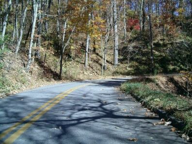
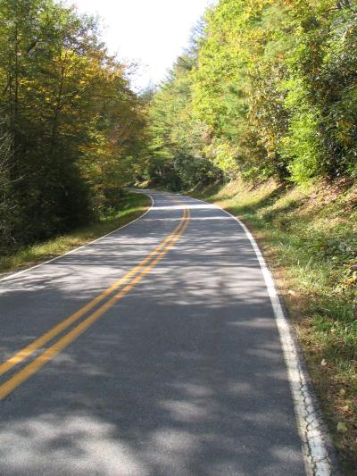
Paint Fork Road
Jacks Creek in the winter with the moon rising
Another route out of town, due north on Bus 19 - aka Merrimon Ave - is less popular with local bicyclists but there is a lot of nice riding north of Weaverville. My favorite easy riding starts at Forks of Ivy - about an hours ride or 15 minute drive - north of Asheville and goes to along the Paint Fork valley in Madison County. You can read about how to get there by bike in my Asheville to the Bicycle Inn web page. By car, just head north on 19/23 and exit at the Forks of Ivy Exit. You can leave your car at the Forks of Ivy shopping center and ride north and east towards Paint Gap. See the web page for the details. That route also goe along Jacks Creek, which is another beautiful, and relatively easy to ride, valley near Burnsville.
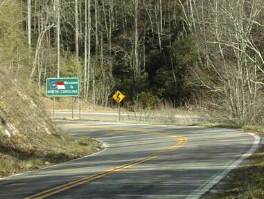
The first 30 miles of the route given in this web page is also my starting route for riding to Tennessee. I think the best riding in NC is in the counties along the TN-NC border and, from Asheville, most of my rides start by going north on Bus 19 and all but one of those follow the first 30 miles of my route to the Bicycle Inn. The ones that don't start that way, go out through Leichester, over Dogget Gap, and north or south on NC 209 which parallels the TN/NC border.
Go via Hotsprings - see the Dogget gap route below, you can go via Dogget or US 25.
Climbing toward Spivey Gap
Go over Spivey Gap (US 19 w - the easiest way) Follow the Bike Inn route to US 19, cross it and turn left on old US 19, turn right on 19 W or follow the Bike Inn route to the Toe river, turn left and follow the roads along the rivers to US 19 W north of Ramsey Town.
Indian Grave Gap
Go over Indian Grave Gap (NC 197) This is very steep on NC side. Follow the Bike Inn route to the Toe river, turn left and follow the road along the river to 197 N.
Iron Mountain Gap
Go over Iron Mountain Gap (NC 226) from Red Hill. this is very pretty on NC side. Follow the Bike Inn route to Red Hill, then go west on 226.
The Roan in winter
Go over Roan Mountain (NC 261) The has the most climbing and the most interesting riding on the TN side. Follow the Bike Inn route to Bakersville, then turn west on 261.
For a really long - ~150 miles - and challenging day ride, ride over one gap, I recommend going over Spivey Gap,and coming back over another gap. I've done Spivey and Iron Mountain which is the shortest ride. See my A January ride over two passes between NC and TN web page
If you want to ride over Roan Mountain, and you should ;-}, I suggest you stay at the Bicycle Inn and do their Roan Moan ride which goes over Iron Mountain Gap and comes back over the Roan. The Bike Inn is also a good base for lots of other rides - from gentle to quite challenging - in this, most beautiful, part of North Carolina.
The French Broad River from an overlook near Hot Springs
For another really challenging ride, go out Old Liechester to 63, then turn right and ride through Liechester on 63 and continue on into Madison County and climb Dogget Gap. It is 25 miles from my house to Dogget Gap. It makes a nice 50 mile out and back ride. This side of Dogget has two miles of steep (8 - 10% grade) climbing. The other side is a longer, much gentler, hill down to 209. If you turn right on 209, you can ride to Hot Springs. If you turn left, you can ride to Lake Junaluska. The riding is spectacular both ways. The ride to Lake Junaluska goes over two more gaps an 209 and you can come back from Lake Junaluska on Lee Rd to Clyde. Old Clyde Rd to Canton and Newfound Rd to Asheville. it is an 85 mile loop with over 8000 feet of climbing through some of the prettiest country in the USA.
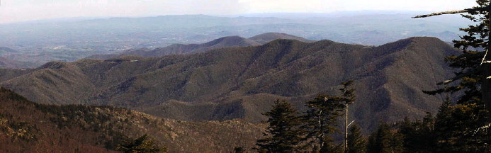
The Blue Ridge Parkway runs along this ridge between Mt
Mitchell and NC 80
photographed from near the restaurant on Mt Mitchell
Another challenging ride is to go east through Black Mountain and Old Fort to near Marion and then to ride NC 80 up to and over the Parkway to Micaville, before riding back through Burnsville on 19 E and Barnardsville on NC 197. See Ride Around The Black Mountains for more info on this ride. you could also ride N 80 up to the Parkway and ride the Parkway back to Asheville which is a shorter trip with more climbing. If you need to add some additional challenge to that ride, just ride up to the top of Mt Mitchell on the way back to Asheville!
My favorite local ride is to ride to the Parkway at Craven Gap on Town Mountain Rd, ride north to Bull Gap, and then take Elk mountain Scenic Highway back to Asheville. This is, depending on where you start and how you route, a 20 to 25 mile loop with roughly 1700 feet of climbing.
I usually ride up Old Toll to get to Town Mountain and ride back to Kimberly Ave on Beaverdam Rd. from the Asheville end of Elk Mountain Scenic Highway. Riding from Beaverdam Rd up Elk Mountain Scenic Highway is also a good, if harder, way to get to the Parkway. When I want to ride south on the Parkway, I ride down through Biltmore Forest.
The shortest way to get to the Parkway from North Asheville, with the least climbing, is to ride out Beaverdam Rd till it ends at Web Cove and then ride Web cove up to Craven Gap. There are two problems with this route: Beaverdam Rd is not safe riding - too much traffic on a narrow road with no shoulders and lots of blind corners - and Webb Cove is mostly dirt with some very coarse gravel dumped on it. It is not a road I'd want to ride with skinny tires!
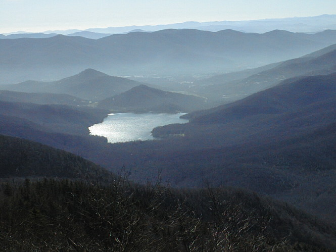
Morning mist on the North fork Reservoir as seen from the Parkway between Craggy and Mt Mitchell
If you want to ride north on the Parkway from east Asheville, the easiest way is to get on at US 70. From South Asheville you can ride through Biltmore Forest to get on the Parkway going either north or south. From West Asheville, you can go down US 119 to get to the Parkway. but traffic around the Biltmore Square Shopping Center makes that route dangerous. You can ride also ride out Sand Creek and US 19 to get to 151. Riding up 151 to the Parkway is, I think, a better ride than riding up the Parkway from 191 to where 151 ends at the top of the big climb to Pisgah. Either rides has about 3500 feet of climbing, but the climb on that part of the Parkway is boring while 151 is fun riding.
If I wanted to go north on the Parkway from west Asheville, I'd ride down to the river on Haywood Rd or Waynesville Rd, cross it and then ride south and then east along the rivers - south along the French Broad and east along the Swannanoa - to get to US 70. Then I'd ride, briefly, on US 70 - it is four lane with lots of traffic there - to Riceville Rd and turn left on Riceville Rd. It is a short ride the back entrance of the Folk Art Center and you can walk your bike around the center to get on the Parkway going north. You can also get on it, via a short dirt path, from Bull Mountain Rd which goes left from Riceville Rd just before the Parkway. Depending on where you are starting from in south Asheville, riding the Swannoanoa River Rd to US 70 may also be the easiest way to get to the Parkway going north.
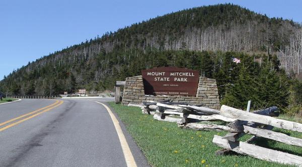
Entering the park on top of Mt Mitchell
I have web pages covering rides on the Parkway south and north of Asheville - north all the way to the end of the Parkway since I did that as a tour and South to Devils Court House since I did that as part of loop ride. I prefer riding north, but I have ridden the Parkway south to Soho Gap near Maggie Valley. Although I think riding to Mt Pisgah on the Parkway is boring, I also think the Parkway from Mt Pisgah south to Richland Balsam - the highest point on the Parkway is some of the best riding anywhere.
Going north on the Parkway from Asheville, I regularly ride to NC 80 which is about 40 miles up the Parkway from the Folk Art Center. I especially like the Parkway between Craggy Gardens and NC 80, but few riders from Asheville go past Craggy Gardens. Riding to Craggy Gardens, like riding to Mt Pisgah, requires over 3000 feet of climbing. However, the climbing is more varied and the view are better riding to Craggy. For many road bicyclists in Asheville, the ultimate ride from Asheville is to ride the Parkway to the top of Mt Mitchell and back. That is a great ride!
See my web pages:
A spring ride past Mt Pisgah
Spring into Winter - Asheville to Mt Mitchell in May
Asheville to Arlington Tour Report
I have a lot of web pages about riding in places all over the US, Canada, and Europe becuase I've spend my summers since 1996 doing solo bicycle tours and creating web pages about them. As you can see in the images on this pages and in my NC web pages, most of my riding around Asheville is done in the fall, winter, and spring. Summer is, now, smog season around here so, if you really want to see how beautiful these mountains are, you'll need to ride in the late fall, winter, or early spring.